アカンダ
アカンダ(フランス語: Commune d'Akanda)は、ガボン・エスチュエール州コモ=モンダー県に位置する都市・コミューン(基礎自治体)。人口は34,548人(2013年国勢調査[2])で、これは国内で10番目に多い。首都リーブルヴィルに隣接している[3]。郊外にはラムサール条約登録地のアカンダ国立公園がある。アカンダ国立公園一帯にはマングローブ、沼地林、サバナなどが広がり、ヒメウミガメ、オサガメ、ヨーロッパトウネン、ダイゼン、シロノドキムネイロムシクイ、フタイロヤブモズ、エトマロサ・フィンブリアタ、ボラなどが生息している[4]。
アカンダ Akanda | ||
|---|---|---|
| ||
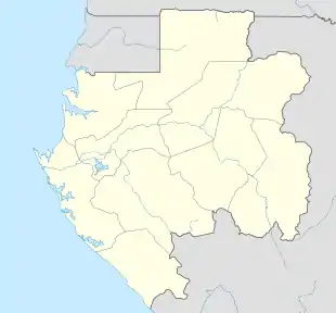  アカンダ | ||
| 北緯0度30分 東経9度30分 | ||
| 国 |
 ガボン ガボン | |
| 州 | エスチュエール州 | |
| 県 | コモ=モンダー県 | |
| 設置 | 2013年2月21日 | |
| 政府 | ||
| • 首長 | Grégory Laccruche[1] | |
| 人口 (2013年) | ||
| • 合計 | 34,548人 | |
| 等時帯 | UTC+1 (西アフリカ時間) | |

2013年2月21日にアンゴンジェ、Avorbam、La Sablière、カプ・エステリアス(およびカプ・エステリアス県)を統合して成立した[5]。
行政区
2013年7月17日以降、2つの行政区(Arrondissement)が設置されている[6]。
| 名称 | 現地語名 | 人口 (2013年[7]) |
|---|---|---|
| カプ・エステリアス(1区) | Cap Estérias | 4,407 |
| アンゴンジェ(2区) | Angondjé | 30,141 |
脚注
- “Commune d’Akanda : Bientôt un marché international et une université.”. Relais Infos Gabon (2019年3月13日). 2019年8月30日閲覧。
- “Gabon:Administrative Division”. Citypopulation.de (2017年7月23日). 2019年8月30日閲覧。
- “The Akanda Sector Plan / Plan de Secteur”. Town Green.com. 2019年8月31日閲覧。
- “Parc National Akanda | Ramsar Sites Information Service”. rsis.ramsar.org (2016年11月15日). 2023年4月12日閲覧。
- “Akanda, la commune de rêve oubliée”. Gabon Review.com (2014年6月27日). 2014年6月29日時点のオリジナルよりアーカイブ。2019年8月30日閲覧。
- “Journal officiel de la République Gabonaise, numéro 189 du 7 au 14 janvier 2014” (pdf). 2018年6月12日時点のオリジナルよりアーカイブ。2019年8月30日閲覧。
- “Résultats globaux du Recensement Général de la Population et des Logements de 2013 DU Gabon (RGPL2013)” (pdf). 2019年8月30日閲覧。
This article is issued from Wikipedia. The text is licensed under Creative Commons - Attribution - Sharealike. Additional terms may apply for the media files.