アルトミュールタール自然公園
アルトミュールタール自然公園 (ドイツ語: Naturpark Altmühltal)は、ドイツ・バイエルン州の自然公園。規模は2,962 km²[1]。インゴルシュタットのすぐ北側にあり、アルトミュール川によって東西に分けられている[2][3]。
| アルトミュールタール自然公園 | |
|---|---|
| ドイツ語: Naturpark Altmühltal | |
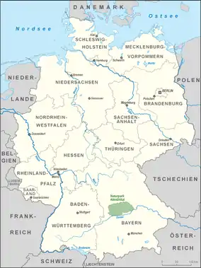 公園の位置(緑) | |
| 地域 | フレンキシェ・アルプ |
| 座標 | 北緯48度49分04秒 東経11度13分37秒 |
| 面積 | 2,962 km2 (1,144 sq mi)[1] |
| 選定 | NP-00016 |
| 創立日 | 1969 |
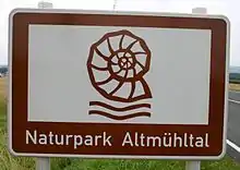
公園の看板
概要
アルトミュールタール自然公園は1969年7月25日にパッペンハイムにて設置された[4]。ドイツの自然公園中4番目の規模を誇る。
自然公園内にはゾルンホーフェン石灰岩の石切場が点在し、始祖鳥を始めジュラ紀の動植物の化石が数多く発掘されている。
地理
範囲
ミッテルフランケン、オーバーバイエルン、ニーダーバイエルン行政管区、シュヴァーベン行政管区、オーバープファルツ行政管区にまたがる広大な敷地を有する。
公園の大部分はアイヒシュテット郡で、一部ヴァイセンブルク=グンツェンハウゼン郡、ドナウ=リース郡、ノイマルクト・イン・デア・オーバープファルツ郡、レーゲンスブルク郡、ロート郡、ケールハイム郡、ノイブルク=シュローベンハウゼン郡が含まれる。
公園内の自治体
|
関連項目
脚注
- Area of the nature park:
– 2962 km²: Liste der Naturparke (Association of German Nature Parks), retrieved 20 August 2014, at naturparke.de
according to other sources:
– 2967 km²: Der Naturpark Altmühltal, retrieved 12 October 2016, at naturpark-altmuehltal.de (pdf; 67.16 KB) - Map services of the Federal Agency for Nature Conservation
- Map Service Landschaften shows the boundaries of individual sub-regions and produces landscape fact files with areas (82xxx=Südliche Frankenalb) clickable (JavaScript required, very restricted browser compatibility)
- Map Service Schutzgebiete shows hill heights down to TK 25;
nature reserves, special areas of conservation, nature parks (with areas), major units and communal boundaries are displayable (flash player required)
- Naturpark Altmühltal, retrieved 24 April 2014, at openstreetmap.org
- Der Naturpark Altmühltal, retrieved 12 October 2016, at naturpark-altmuehltal.de (pdf; 67.16 KB)
文献
- Das Tal der Uraltmühl, 144 Seiten, Tümmels, Nuremberg, ISBN 3-921590-98-1
- Das Urdonautal der Altmühl, 132 Seiten, Tümmels, Nuremberg, ISBN 3-921590-88-4
外部リンク
- Altmühl Valley Nature Park, at naturpark-altmuehltal.de
This article is issued from Wikipedia. The text is licensed under Creative Commons - Attribution - Sharealike. Additional terms may apply for the media files.