イサベラ (バシラン州)
イサベラ市(Isabela)はフィリピン南西部、ミンダナオ島の沖合のバシラン島にある都市で、バシラン州の州都である。市街地はバシラン島の北岸に位置し、バシラン海峡をはさんだ北にはサンボアンガ市がある。2000年国勢調査では、人口は73,032人、世帯数は13,753世帯。
イサベラ Isabela | |
|---|---|
|
都市 | |
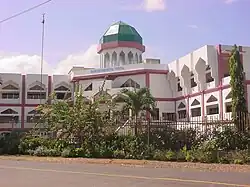 Basilan Provincial Capitol, former site of Fort Isabella Segunda | |
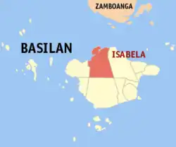 | |
.svg.png.webp)  イサベラ Location within the Philippines .svg.png.webp) イサベラ イサベラ (ミンダナオ島) | |
| 北緯06度42分 東経121度58分 | |
| 国 | フィリピン |
| 地方 | サンボアンガ半島地方 (Region IX) |
| 州 | サンボアンガ半島地方 |
| District | Lone district of Basilan |
| Founded | 1848 |
| Cityhood | April 25, 2001 |
| バランガイ | 45 |
| 政府 | |
| • 市長 | Cherrylyn Santos-Akbar |
| 面積 | |
| • 合計 | 233.73 km2 |
| 人口 (2010)[3] | |
| • 合計 | 130,379人 |
| • 密度 | 560人/km2 |
| 等時帯 | UTC+8 (PHT) |
| 郵便番号 |
7300 |
| 電話番号 | 62 |
| Income class | 4th class; partially urban |
| ウェブサイト |
www |
面積は223.73平方kmで、バランガイ数は45。2001年4月25日に市になった。地名はかつて、スペイン女王イサベル2世を称えて付けられたものである。
行政区分上は複雑である。バシラン州自体はバンサモロ自治地域に属するが、イサベラ市はバシラン州の一部ながらサンボアンガ半島地方に属している。イサベラ市では、バシラン島の他の町やスールー諸島の他の島と同様、イスラム教過激派・アブ・サヤフと政府軍との激しい戦闘が起こっている。
脚注
- “Official City/Municipal 2013 Election Results”. Intramuros, Manila, Philippines: Commission on Elections (COMELEC) (2014年5月12日). 2014年8月20日閲覧。
- “Land Area”. www.basilan.gov.ph. Province of Basilan. 2014年8月20日閲覧。
- “Total Population by Province, City, Municipality and Barangay: as of May 1, 2010”. 2010 Census of Population and Housing. National Statistics Office. 2014年8月14日閲覧。
This article is issued from Wikipedia. The text is licensed under Creative Commons - Attribution - Sharealike. Additional terms may apply for the media files.