イニッシュトラウール島
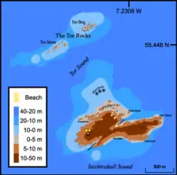
イニッシュトラウール島(アイルランド語:InisTráTholl)は、アイルランドで最も北に位置する島。 島には1929年まで居住地区があり、アイルランド最北端の灯台には1987年まで人が住んでいたが[2]、以降は無人であり、野生生物のために保護区に指定されている。
イニッシュトラウール Inis Trá Tholl | |
|---|---|
 | |
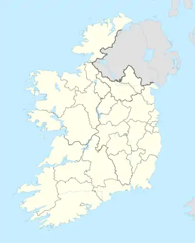  イニッシュトラウール アイルランド内の位置 | |
| 座標:北緯55度25分48秒 西経7度14分02秒 | |
| Sovereign state |
 アイルランド アイルランド |
| 面積 | |
| • 合計 | 0.34[1] km2 |
| 標高 | 49 m |
| 人口 (2011) | |
| • 合計 | 0人 |
地質
島はイニッシュトラウール片麻岩として知られている変成岩の一種である花崗岩および片麻岩で構成される。 17億年の古原生代であり、アイルランド諸島で最も古くから知られている岩である。 イニッシュトラウール片麻岩は、アイラ島とコロンゼー島にも露出しているリンス複合岩体の一部を形成していると考えられている。 この複合岩体はグリーンランド南部の変成帯およびスカンディナヴィアと相関があるとされる[3]。
脚注
- Per Ivar Haug, Gazetteer of Ireland, Trondheim University 2007. Archived 19 April 2008 at the Wayback Machine.
- “Ireland - Geographical facts and figures”. Travel through the Ireland story.... 2007年9月15日閲覧。
- Muir, R.J.; Fitches W.R.; Maltman A.J. (1994). “The Rhinns Complex: Proterozoic basement on Islay and Colonsay, Inner Hebrides, Scotland, and on Inishtrahull, NW Ireland”. Transactions of the Royal Society of Edinburgh: Earth Sciences 85 (1): 77–90. doi:10.1017/s0263593300006313 2012年9月15日閲覧。.
This article is issued from Wikipedia. The text is licensed under Creative Commons - Attribution - Sharealike. Additional terms may apply for the media files.