ウムアヒア
ウムアヒア(英語:Umuahia[ʊmʊaːhiaː])はナイジェリア南東部のアビア州の州都。 [2][3][4] 2006年の人口は約35.9万人。
ウムアヒア Umuahia | |
|---|---|
|
州都 | |
 左上段:アビア塔 右上段:星ビールの歓迎看板 左中段:時計塔 中段:BCAラジオ塔 右中段:市場 左下段:連邦高等裁判所 右下段:警察署 | |
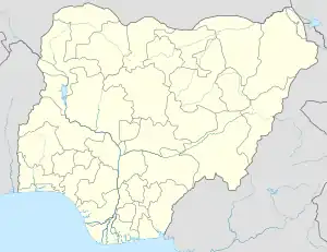  ウムアヒア ウムアヒアの位置 | |
| 北緯5度32分 東経7度29分 | |
| 国 |
 ナイジェリア ナイジェリア |
| 州 | アビア州 |
| 人口 (2006年)[1] | |
| • 合計 | 359,230人 |
| 等時帯 | UTC+1 (西アフリカ時間) |
| 郵便番号 |
440... |
| 市外局番 | 088 |
民族
歴史
イボ人のウムオクパラ族、イベク族、オロコロ族、ウバカラ族、オフフ族の5つの氏族が住んでいた。
1914年、イギリスがイギリス領ナイジェリアに組み込んだ。
1916年、野菜市場が設置された。
1967年9月28日、ビアフラ共和国の2番目の首都になった。 これは最初の首都のエヌグがナイジェリア政府軍に占領された為である。
1968年6月28日、政府軍のOAU作戦によって占領された。 7月23日、ビアフラ共和国が再占領した。
1969年4月22日、再び政府軍に占領されかけたが、押し返した。 12月24日、政府軍に占領された。 首都はオウェリに移った。
脚注
- Summing the 2 LGAs Umuahia North/South as per:
Federal Republic of Nigeria Official Gazette (2007年5月15日). “Legal Notice on Publication of the Details of the Breakdown of the National and State Provisional Totals 2006 Census” (PDF). 2010年7月1日閲覧。 - “The 'Gate' of Umuahia”. Vanguardngr.com (Vanguard Media). (2013年10月1日) 2014年3月30日閲覧。
- “The latitude and longitude gps coordinates of Umuahia (Nigeria)”. The GPS Coordinates.net 2014年3月30日閲覧。
- “ABIA State of Nigeria”. USAfricaonline.com 2014年3月30日閲覧。
This article is issued from Wikipedia. The text is licensed under Creative Commons - Attribution - Sharealike. Additional terms may apply for the media files.