エタール環礁
エタール環礁(エタールかんしょう、英語: Ettal,Ettal)は太平洋西部カロリン諸島の環礁。ミクロネシア連邦チューク州に属している[1]。
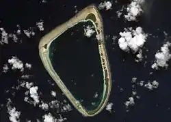 NASAの撮影したエタール環礁。 | |
| 地理 | |
|---|---|
| 場所 | 北西太平洋 |
| 座標 | 北緯5.5793度 東経153.5869度 |
| 諸島 | カロリン諸島、ノモイ諸島 |
| 行政 | |
| 州 | チューク州 |

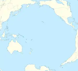

エタール
エタール環礁の位置
地理
エタール環礁は17の島からなる小型の環礁である。多くの島はココヤシとパンノキが生えている[3]。
主な島には最大のエタール島、2番目に大きいパラン島(Parang)、ウノン島(Unon)などであり、それぞれ環礁の南東、北部、西部に位置している。エタール島は2000年の国勢調査において267人の人口を持っている[4]。
註
- Statoids.com, retrieved December 8, 2010
- Oceandots - Etal - ウェイバックマシン(2010年12月23日アーカイブ分)
- National Geospatial-Intelligence Agency: Sailing Directions (enroute), Pub. 126, Pacific Ocean
- Chuuk State Census Report, 2000
外部リンク
This article is issued from Wikipedia. The text is licensed under Creative Commons - Attribution - Sharealike. Additional terms may apply for the media files.