オーストステリングウェルフ
オーストステリングウェルフ(オランダ語: Ooststellingwerf [ˈoːststɛlɪŋˌʋɛr(ə)f] ( 音声ファイル))は、オランダ北部のフリースラント州にある基礎自治体(ヘメーンテ)。西フリジア語ではなく、オランダ低ザクセン語のステリングワルフ方言が話される。
オーストステリングウェルフ | |||
|---|---|---|---|
|
基礎自治体 | |||
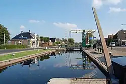 アッペルスハを通る運河の閘門 | |||
| |||
.svg.png.webp) | |||
| 北緯53度0分 東経6度18分 | |||
| 国 | オランダ | ||
| 州 | フリースラント州 | ||
| 政府 | |||
| • 議会 | 議会民主制 | ||
| • 市長 | ハリー・オーステルマン (労働党) | ||
| 面積 | |||
| • 合計 | 226.11 km2 | ||
| • 陸地 | 224.16 km2 | ||
| • 水域 | 1.95 km2 | ||
| 標高 | 7 m | ||
| 人口 (2013年11月)[4] | |||
| • 合計 | 25,677人 | ||
| • 密度 | 115人/km2 | ||
| 等時帯 | UTC+1 (中央ヨーロッパ標準時) | ||
| • 夏時間 | UTC+2 (中央ヨーロッパ夏時間) | ||
| 郵便番号 |
8420–8435 | ||
| 市外局番 | 0516 | ||
| ウェブサイト |
www | ||


地区
|
|
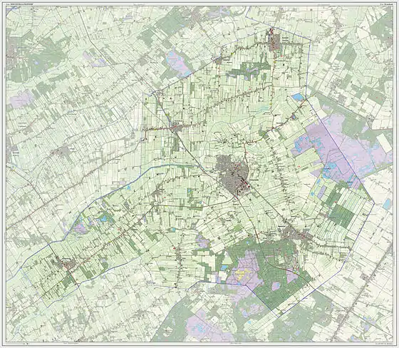
2013年のオーストステリングウェルフ市の地図
脚注
- “College” [Executive board] (Dutch). Gemeente Ooststellingwerf. 2013年9月22日閲覧。
- “Kerncijfers wijken en buurten” [Key figures for neighbourhoods] (Dutch). CBS Statline. CBS (2013年7月2日). 2013年7月11日閲覧。
- “Postcodetool for 8431LE” (Dutch). Actueel Hoogtebestand Nederland. Het Waterschapshuis. 2013年9月22日閲覧。
- “Bevolkingsontwikkeling; regio per maand” [Population growth; regions per month] (Dutch). CBS Statline. CBS (2013年12月23日). 2013年12月24日閲覧。
外部リンク
- 公式サイト (オランダ語)
This article is issued from Wikipedia. The text is licensed under Creative Commons - Attribution - Sharealike. Additional terms may apply for the media files.