カセセ
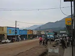
カセセ(Kasese)はウガンダの西部地域西部のカセセ県の県都。人口は約11万人(2020年)。ルウェンゾリ地域の最大都市である。市域の約1/3をキバレ森林国立公園が占める。キレンベの銅山周辺で発展したが、後にコバルト採掘が中心になった。ルウェンゾリのチャールズ・ムンベレ王の宮殿が有る。
カセセ Kasese | |
|---|---|
 | |
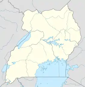  カセセ カセセの位置 | |
| 北緯0度11分12秒 東経30度05分17秒 | |
| 国 |
 ウガンダ ウガンダ |
| 地域 | 西部地域 |
| 小地域 | ルウェンゾリ地域 |
| 県 | カセセ県 |
| 標高 | 1,000 m |
| 人口 (2020年)統計[1] | |
| • 合計 | 115,400人 |
| ケッペンの気候区分 | サバナ気候(Aw) |
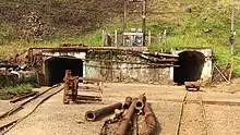
キレンベ銅山
人口動態
- 観光客の増加:クイーン・エリザベス国立公園とルウェンゾリ山地国立公園の入口である[5]
- キレンベ鉱山の雇用:2015年1月時点で3000人以上[6][7]
- ヒマ・セメントの雇用:約24km北のヒマに有る[8]
- コンゴ民主共和国の北キヴ州との貿易の増加:国境の町のムポンドウェは、道なりで約61km南西に位置する
脚注
- “City Population”. 2023年4月16日閲覧。
- GFC (2016年5月13日). “Distance between Uganda Post Office, Kampala Road, Kampala, Central Region, Uganda and Kasese Post Office, Rwenzori Road, Kasese, Western Region, Uganda”. Globefeed.com (GFC). 2016年5月13日閲覧。
- GFC (2014年5月13日). “Distance Between Kasese Post Office, Rwenzori Road, Kasese, Western Region, Uganda and Mpondwe Customs Police Station, Bukonjo, Western Region, Uganda”. Globefeed.com (GFC). 2014年5月13日閲覧。
- Alex Kwatampora Binego (2014年1月10日). “Causes of River Nyamambwa floods”. 2016年5月13日閲覧。
- UWO (2016年5月13日). “Rwenzori Mountains National Park: Tourism: "Kasese, 437 km west of Uganda's capital Kampala, is the gateway to the park"”. Entebbe: Ugandawildlife.org (UWO). 2016年5月13日閲覧。
- Mugira, Fredrick (2015年1月31日). “Chinese consortium to revive Uganda’s copper mines”. China Africa Reporting. 2016年5月13日閲覧。
- Khisa, Isaac (2015年1月10日). “Copper production to resume at Kilembe”. 2016年5月13日閲覧。
- GFC (2016年5月13日). “Distance between Kasese, Western Region, Uganda and Hima, Western Region, Uganda”. Globefeed.com (GFC). 2016年5月13日閲覧。
- Enid Ninsiima, and Thembo Kahungu Misairi (2015年9月13日). “Four killed as floods sweep Kilembe Mines hospital”. 2015年7月1日閲覧。
- Thawite, John (2013年6月4日). “Kilembe Hospital re-opens”. 2015年9月13日閲覧。
- John Thawite, and Taddeo Bwambale (2014年5月8日). “Five perish as fresh floods hit Kasese”. 2015年9月13日閲覧。
This article is issued from Wikipedia. The text is licensed under Creative Commons - Attribution - Sharealike. Additional terms may apply for the media files.