ガサ (ブータン)
ガサは、ブータン北西部、ガサ県の庁舎(ガサ・ゾン)がある町。標高、2,761 m[1]。2013年の調査では、人口は548人 [2]。
ガサ | |
|---|---|
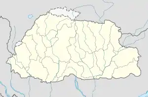  ガサ ブータンにおけるガサの位置 | |
| 座標:北緯27度55分 東経89度41分 | |
| 国 |
 ブータン ブータン |
| 県(ゾンカク) | ガサ県 |
| 標高 | 9,058 ft (2,761 m) |
| 人口 (2013) | |
| • 合計 | 548人 |
| 等時帯 | UTC+6 (ブータン標準時) |
首都ティンプーから直線距離で50 km、道路では133 km、車で4時間16分。ガサ温泉がある [3]。
年平均気温は2℃。最も暖かい5月はマイナス5〜13℃。寒い2月はマイナス7〜5℃[4]。年間降水量は1,010 mm。雨は5〜9月によく降る[5]。
参考文献
- “NGA GeoName Database”. National Geospatial Intelligence Agency. 2008年6月8日時点のオリジナルよりアーカイブ。2008年7月3日閲覧。
- Gasa on GeoNames.Org (cc-by); post updated 2013-08-26; database download on 2015-05-11
- “Gasa, ブータン”. Google マップ. 2022年3月30日閲覧。
- “NASA Earth Observations Data Set Index”. NASA. 2016年1月30日閲覧。
- “NASA Earth Observations: Rainfall (1 month - TRMM)”. NASA/Tropical Rainfall Monitoring Mission. 2016年1月30日閲覧。
This article is issued from Wikipedia. The text is licensed under Creative Commons - Attribution - Sharealike. Additional terms may apply for the media files.