キヌエティ山
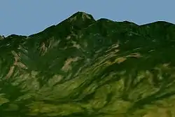
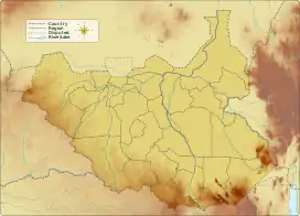
キヌエティ山 (Kinyeti) は、南スーダンの最高峰。ウガンダ国境に近い東エクアトリア州イコトス郡に位置するイマトング山系(ロマリティ山系、ロロバイ山系とも[1])の山で、標高は3187mある[2]。
| キヌエティ山 | |
|---|---|
 | |
| 最高地点 | |
| 標高 | 3,187 m (10,456 ft) |
| プロミネンス | 2,120 m (6,960 ft) |
| 総称 | 国内最高峰 ウルトラ・プロミネント峰 |
| 座標 | 北緯3度56分51秒 東経32度54分32秒 |
| 地形 | |
  キヌエティ山 南スーダンにおける位置 | |
| 所在地 |  南スーダン 南スーダン |
| 所属山脈 | イマトング山地 |
 プロジェクト 山 プロジェクト 山 | |
ふもとに広がる森林は、東アフリカ山地林エコリージョンの最北部にあたる[3][4]。山頂は草地が点在するものの岩肌で、その割れ目にツツジ科などの潅木や草本がみられる[5]。ヨーロッパ人として初めて山を訪れたうちのひとり、植物学者のトマス・フォード・チップは、山頂付近でキク科の Coreopsis Chippii を発見した[6]。
脚注
- Kaj Vollesen (1998). Flora of the Sudan-Uganda border area east of the Nile, Part 1. Kgl. Danske Videnskabernes Selskab. p. 9. ISBN 87-7304-297-8
- “Mount Kinyeti”. Encyclopædia Britannica. 2011年7月6日閲覧。
- "East African montane forests". Terrestrial Ecoregions. World Wildlife Fund. 2011年7月6日閲覧。
- Paul Clammer (2005). Sudan: the Bradt travel guide. Bradt Travel Guides. p. 5. ISBN 1-84162-114-5
- Kaj Vollesen (2005). Flora of the Sudan-Uganda border area east of the Nile: Catalogue of vascular plants, 2nd part, vegetation and phytogeography, Part 2. Kgl. Danske Videnskabernes Selskab. ISBN 87-7304-318-4
- Earl Edward Sherff (1936年10月20日). “Revision of the Genus Coreopsis”. Field Museum of Natural History, Chicago. 2013年2月9日閲覧。
This article is issued from Wikipedia. The text is licensed under Creative Commons - Attribution - Sharealike. Additional terms may apply for the media files.