キル (ウォーターフォード県)
キル(英語: Kill、アイルランド語: an Chill)は、アイルランド・マンスター地方ウォーターフォード県の村[1]。人口は349人(2022年国勢調査[2])。
| キル Kill an Chill | |
|---|---|
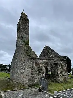 キル教会の廃墟(2021年撮影) | |
| 位置 | |
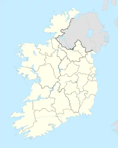  キル キル (アイルランド) | |
| 座標 : 北緯52度10分33.6秒 西経7度20分6秒 | |
| 行政 | |
| 国 |  アイルランド アイルランド |
| 地方 |  マンスター マンスター |
| 県 | ウォーターフォード県 |
| 村 | キル |
| 地理 | |
| 面積 | |
| 村域 | 0.19 km2 |
| 人口 | |
| 人口 | (2022年現在) |
| 村域 | 349人 |
| 人口密度 | 1,837人/km2 |
| その他 | |
| 等時帯 | 西ヨーロッパ時間 (UTC+0) |
| 夏時間 | 西ヨーロッパ夏時間 (UTC+1) |
地域道R681号線沿い、ダンガーヴァンとTramoreの間に位置する[3]。タウンランド(Townland)はキルバリーメーデン(Kilbarrymeaden)とSleveenに所属している。
村名はアイルランド語で教会を意味し[1]、かつての中世の教区キルバリーメーデンに由来する。キルバリーメーデンは村から南西に2キロメートルの場所にある[4]。
パブはThe WellとDunphy'sの2店舗がある[5]。
出典
- “An Chill/Kill”. en:Placenames Database of Ireland (logainm.ie). 2022年1月5日閲覧。
- “Kill (Ireland)”. Citypopulation (2023年9月29日). 2024年5月2日閲覧。
- “County Waterford Towns and Villages, their history and cultural heritage - Kill”. 2011年7月18日時点のオリジナルよりアーカイブ。2010年7月24日閲覧。
- “Kilbarrymeaden - Lewis's Topographical Dictionary - Waterford County - Waterford County Museum”. 2021年4月12日時点のオリジナルよりアーカイブ。2021年4月12日閲覧。
- “County Waterford Towns and Villages, their history and cultural heritage - Pubs”. 2011年7月18日時点のオリジナルよりアーカイブ。2010年7月24日閲覧。
This article is issued from Wikipedia. The text is licensed under Creative Commons - Attribution - Sharealike. Additional terms may apply for the media files.