クランブルック
クランブルック(英: Cranbrook)は、カナダのブリティッシュコロンビア州イースト・クートニー地域の都市。イースト・クートニー地域の行政府がおかれている。
クランブルック Cranbrook | |
|---|---|
| City of Cranbrook | |
 市街中心地 | |
|
標語: 機会の山(Mountains of Opportunity) | |
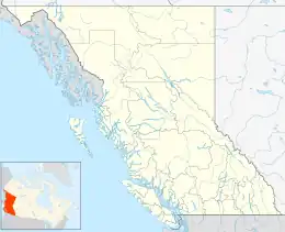  クランブルック クランブルック | |
| 座標:北緯49度30分29秒 西経115度44分49秒 | |
| 国 |
 カナダ カナダ |
| 州 |
 ブリティッシュコロンビア州 ブリティッシュコロンビア州 |
| 行政区 | イースト・クートニー地域 |
| 創設 | 1898 |
| 市制施行 | 1905 |
| 面積 | |
| • 陸地 | 31.97 km2 |
| 標高 | 921 m |
| 人口 | |
| • 合計 | 20,499人 |
| • 密度 | 641.2人/km2 |
| 等時帯 | UTC-8 (PST) |
| • 夏時間 | UTC-7 (PDT) |
| ウェブサイト | 公式ウェブサイト |
クートニー川とセントメリーズ川の交点の南西に位置し[4]、人口は約2万人[1]。

ウェルカム・サイン
歴史
この地域は従来クートニー族の居住地域であった。欧州からの入植者たち、特にイギリスの軍人ジェームス・ベーカー(James Baker)などが1880年代にこの地で居住を始める。彼はカナダ太平洋鉄道をこの地を通るようにすることに成功し、結果として町が発展する。1905年に、正式に市制施行した。
交通
- クランブルック・カナディアンロッキーズ国際空港(YXC/CXYC)
脚注
- “Census Profile, 2021 Census of Population - Profile table: Cranbrook, City (CY), British Columbia [Census subdivision]”. Statistics Canada (2023年2月1日). 2023年2月25日閲覧。
- “Census Profile, 2021 Census of Population - Profile table: Cranbrook, British Columbia [Census agglomeration]” (2023年2月1日). 2023年2月25日閲覧。
- “Census Profile, 2021 Census of Population - Profile table: Cranbrook, British Columbia [Population centre]” (2023年2月1日). 2023年2月25日閲覧。
- BCGNIS entry "Cranbrook (city)"
外部リンク
This article is issued from Wikipedia. The text is licensed under Creative Commons - Attribution - Sharealike. Additional terms may apply for the media files.