クンタウル
クンタウル(Kuntaur)はガンビア共和国東部の中流地方の都市。 ガンビア川の北岸に面している。 1993年の人口は2286人だった。
| クンタウル Kuntaur | |
|---|---|
| 位置 | |
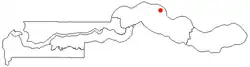 クンタウルの位置 | |
| 位置 | |
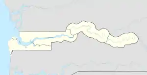  クンタウル クンタウル (ガンビア)  クンタウル クンタウル (アフリカ) | |
| 座標 : 北緯13度40分 西経14度53分 | |
| 行政 | |
| 国 |  ガンビア ガンビア |
| 地方 | 中流地方 |
| 地区 | ニアニ地区 |
| 市 | クンタウル |
| その他 | |
| 等時帯 | グリニッジ標準時 (UTC+0) |
地理
クンタウルは、ガンビア川の北岸、ワッスから南に約3キロメートル、ジャンジャンブレアから北に13キロメートル、ニアニ地区の中央川管区にある。重要高速道路であるノースバンクロードは有名なワッスストーンサークルがあるワッスを横切る。
文化的名所
近隣にネガンビアの環状列石の中で礼拝の場所とみなされているSererなど[1]
脚注
- Meagher, Allen (pub), Historic sites of The Gambia. Ada Dinkiralu (Mandinka), Bereb-I-Chosan (Wolof), Tarica Tawal (Fula), Nannin (Jola), Soninke Ada (Serehuli), I-Mofan Chosan (Serer). An official guide to the monuments and sites of The Gambia. National Council for Arts and Culture, Banjul The Gambia (1998), p.15-16, OCLC 67789910
This article is issued from Wikipedia. The text is licensed under Creative Commons - Attribution - Sharealike. Additional terms may apply for the media files.