サムサリ山
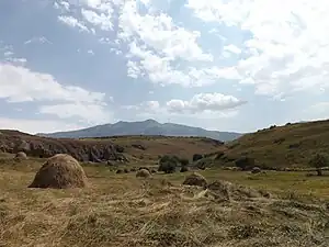
サムサリ山(სამსარი)は、ジョージア南部にあるアブル=サムサリ山脈の最高峰。標高は海抜3,285メートル。
| サムサリ山 | |
|---|---|
 | |
| 標高 | 3,285 m |
| 所在地 |
 ジョージア ジョージア |
| 位置 | 北緯41度32分8.16秒 東経43度40分14.88秒 |
| 山系 | アブル=サムサリ山脈 |
 プロジェクト 山 プロジェクト 山 | |
サムサリ山は火山円錐丘であり、半円状の隆起が直径3キロメートルのカルデラを囲んでいる。 このカルデラは約20万年前に形成されたものであり、局所的な断層系と密接に関連している。カルデラの底面は岩や氷の破片で覆われており、小さな湖や火山カルスト地形が並んでいるカルデラの縁には圏谷をはじめとする、過去の氷河の痕跡が残っている。
出典
- Georgian State (Soviet) Encyclopedia. 1985. Book 9. p. 33.
- The Structural Position and Conditions of Formation of the Samsari Caldera Volcano (Javakheti Upland, Georgia), Bezhan Tutberidze, Mariam Akhalkatsishvili, Hamlet Salukvadze.
- The Samsari Volcanic Center as an Example of Recent Volcanism in the Lesser Caucasus: K–Ar Geochronological and Sr–Nd Isotopic Data DOKLADY EARTH SCIENCES Vol. 393A No. 9 2003
This article is issued from Wikipedia. The text is licensed under Creative Commons - Attribution - Sharealike. Additional terms may apply for the media files.