サンペドロ (カリフォルニア州)
サンペドロ (スペイン語: San Pedro) はカリフォルニア州ロサンゼルスの海岸地区に所在する町。1909年に合併し、同地区の主要な港である。サンペドロ湾に臨むロサンゼルス南部の港湾地区。サンペドロは漁業により発展した。軍事基地がある[2]。サンピドロともいう。サンペドロのターミナルアイランドには和歌山県などから移民した日系人が3500人ほどいて漁業に従事して、日本人村が形成されていた。日本語の漢字表記は、散港。詳しくは、竹内幸助編『サンピドロ同胞発展録』(竹内幸助 1937年)を参照。
サンペドロ San Pedro | |
|---|---|
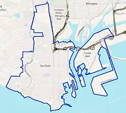 Boundaries of San Pedro as drawn by the Los Angeles Times | |
| 座標:北緯33.74度 西経118.29度 | |
| 国 |
 アメリカ合衆国 アメリカ合衆国 |
| 標高 | 34 m |
| 人口 | |
| • 合計 | 86,000人 |
| 等時帯 | UTC−8 (PST) |
| • 夏時間 | UTC−7 (PDT) |
| 市外局番 | 310/424 |
| GNIS feature ID | 1661392 |
| Boundaries of San Pedro as drawn by the Los Angeles Times | |
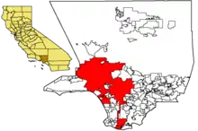
サンペドロはロサンゼルスとはハーバー・ゲートウェイによって接続される。
地理
サンペドロの位置は北緯33度44分9秒 西経118度17分32秒である。
教育
7位通り小学校
15位通り小学校
テーパー小学校
ホワイトポイント小学校
サウスショアズ小学校
サンペドロ高校
ロサンゼルス港高校
脚注
- "San Pedro". Geographic Names Information System. U.S. Geological Survey. 2018年1月7日閲覧。
- “Fort MacArthur”. SanPedro.com - San Pedro, California. 2023年7月26日閲覧。
外部リンク
- From Bridge to Breakwater Waterfront and Promenade Master Development Plan
- San Pedro homepage
- Port of Los Angeles
- Japanese Immigrants at Terminal Island
- Japanese Immigrants at White Point
- Port of Los Angeles Waterfront Red Car Line
- Furasato: The lost Village of Terminal Island
- Citizens For A Harbor Line
- Croatian community.
- Random Lengths news weekly
- Southern California Croats
- San Pedro/Los Angeles Croatians
This article is issued from Wikipedia. The text is licensed under Creative Commons - Attribution - Sharealike. Additional terms may apply for the media files.