サン・フアン・サカテペケス
サン・フアン・サカテペケス(スペイン語:San Juan Sacatepéquez) (スペイン語発音: [saŋ ˈxwan sakateˈpekes])は、グアテマラのグアテマラ県の都市。 2016年の人口は12万9600人[1]で、国内6位。 首都グアテマラ市の北西に位置する。
サン・フアン・サカテペケス San Juan Sacatepéquez | |
|---|---|
|
都市 | |
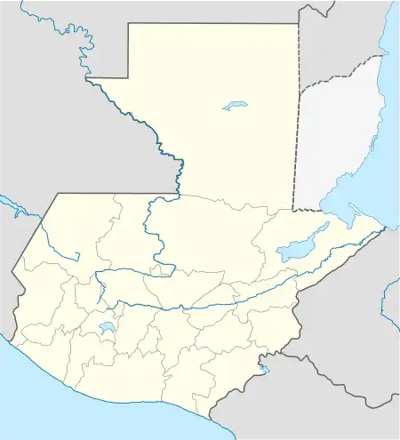  サン・フアン・サカテペケス サン・フアン・サカテペケスの位置 | |
| 北緯14度43分8秒 西経90度38分39秒 | |
| 国 |
 グアテマラ グアテマラ |
| 県 | グアテマラ県 |
| 政府 | |
| • 市長 | Fernando Bracamonte (グアテマラ愛国党) |
| 人口 | |
| • 合計 | 129,600人 |
| ケッペンの気候区分 | 海洋性気候(Cwb) |
気候
| サン・フアン・サカテペケスの気候 | |||||||||||||
|---|---|---|---|---|---|---|---|---|---|---|---|---|---|
| 月 | 1月 | 2月 | 3月 | 4月 | 5月 | 6月 | 7月 | 8月 | 9月 | 10月 | 11月 | 12月 | 年 |
| 平均最高気温 °C (°F) | 21.5 (70.7) |
22.6 (72.7) |
23.9 (75) |
24.4 (75.9) |
24.0 (75.2) |
22.5 (72.5) |
22.6 (72.7) |
23.0 (73.4) |
22.3 (72.1) |
21.5 (70.7) |
21.6 (70.9) |
21.6 (70.9) |
22.63 (72.73) |
| 日平均気温 °C (°F) | 15.6 (60.1) |
16.4 (61.5) |
17.3 (63.1) |
18.3 (64.9) |
18.4 (65.1) |
18.0 (64.4) |
17.9 (64.2) |
18.0 (64.4) |
17.6 (63.7) |
16.9 (62.4) |
16.4 (61.5) |
15.8 (60.4) |
17.22 (62.98) |
| 平均最低気温 °C (°F) | 9.8 (49.6) |
10.2 (50.4) |
10.8 (51.4) |
12.3 (54.1) |
12.9 (55.2) |
13.6 (56.5) |
13.2 (55.8) |
13.0 (55.4) |
12.9 (55.2) |
12.4 (54.3) |
11.3 (52.3) |
10.1 (50.2) |
11.88 (53.37) |
| 降水量 mm (inch) | 6 (0.24) |
4 (0.16) |
3 (0.12) |
37 (1.46) |
111 (4.37) |
250 (9.84) |
201 (7.91) |
201 (7.91) |
248 (9.76) |
122 (4.8) |
29 (1.14) |
6 (0.24) |
1,218 (47.95) |
| 出典:Climate-Data.org[2] | |||||||||||||
関連項目
- チャホマ人
脚注
- City Population閲覧日:2017年2月10日
- “Climate: San Juan Sacatepéquez”. Climate-Data.org. 2015年9月19日閲覧。
- “Municipios del departamento de Guatemala” (スペイン語). SEGEPLAN. 2015年7月7日時点のオリジナルよりアーカイブ。2015年7月22日閲覧。
参考文献
- Juarros, Domingo (1818) (スペイン語). Compendio de la historia de la Ciudad de Guatemala. Guatemala: Ignacio Beteta
- van Oss, Adriaan C. (1986). Catholic Colonialism: A Parish History of Guatemala, 1524-1821. Cambridge, UK: Cambridge University Press
This article is issued from Wikipedia. The text is licensed under Creative Commons - Attribution - Sharealike. Additional terms may apply for the media files.