シブツ
シブツはフィリピン、タウィタウィ州の第6級自治体。2010年の国勢調査によると人口は28,532人である[2]。マレーシアサバ州から14kmほど東の位置に存在する。自治体はシブツ島とその南3.5-6km程の位置にある小さな無人島を領域としている。小島は北からシコラン・カルチ島(Sicolan Calch Island)、シコラン島(Sicolan Island)、シコラン小島(Sicolan Islet)、サルアグ島(Saluag Island)の4島である。サルアグ島はフィリピン最南端の島となっている。
シブツ | |
|---|---|
|
自治体 | |
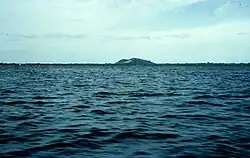 | |
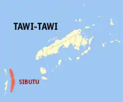 Map of タウイタウイ with Sibutu highlighted | |
.svg.png.webp)  シブツ Location within the フィリピン | |
| 北緯04度51分 東経119度28分 | |
| 国 |
 フィリピン フィリピン |
| 地方 | バンサモロ自治地域 (BARMM) |
| 州 | タウィタウィ州 |
| 選挙区 | タウィタウィ選挙区 |
| 設立 | 21, 2006年10月21日 |
| バランガイ | 16 |
| 政府 | |
| • 市長 | Kuyoh Pajiji |
| 人口 (2010)[2] | |
| • 合計 | 28,532人 |
| 等時帯 | UTC+8 (PST) |
| 郵便番号 |
7510 |
| 電話番号 | 68 |
| 収入 | 第6級 |
歴史
パリ条約の行政的手違いによって、カガヤン・デ・ホロと並んでシブツはフィリピン諸島で最後のスペイン領となった。
イスラム教徒ミンダナオ自治法第197号によってシブツの西にあるシタンカイ島などからシタンカイ自治体が作られ、その後2006年10月21日に行われた住民投票で批准された[4]。
バランガイ
- Ambutong Sapal
- Datu Amilhamja Jaafar
- Hadji Imam Bidin
- Hadji Mohtar Sulayman
- Hadji Taha
- Imam Hadji Mohammad
- Ligayan
- Nunukan
- Sheik Makdum
- Taungoh
- Talisay
- Tandu Banak
- Tandu Owak
- Tongehat
- Tongsibalo
- Ungus-ungus
人口
| シブツの人口 | ||
|---|---|---|
| 年 | 人口 | ±% 増減 |
| 2007 | 35,377 | — |
| 2010 | 28,532 | −7.53% |
| 出展: 国家統計局[2] | ||
註
- “Official City/Municipal 2013 Election Results”. Intramuros, Manila, Philippines: Commission on Elections (COMELEC) (2013年7月1日). 2013年9月5日閲覧。
- “Total Population by Province, City, Municipality and Barangay: as of May 1, 2010”. 2010 Census of Population and Housing. National Statistics Office. 2014年9月1日閲覧。
- Danielsen, Finn & Treadaway, Colin G., 2004: Priority conservation areas for butterflies (Lepidoptera: Rhopalocera) in the Philippine Islands. Animal Conservation, 7, 79-92.
- MMA Act No. 197 : An Act Creating the Municipality of Sibutu in the Province of Tawi-Tawi
外部リンク
- Landsat images
- NSCB: newly created provinces, municipalities, barangays, converted city Accessed on March 9, 2006.
This article is issued from Wikipedia. The text is licensed under Creative Commons - Attribution - Sharealike. Additional terms may apply for the media files.