シャンパーニュ=シュル=セーヌ
シャンパーニュ=シュル=セーヌ (Champagne-sur-Seine)は、フランス、イル=ド=フランス地域圏、セーヌ=エ=マルヌ県のコミューン。
| Champagne-sur-Seine | |
|---|---|
.svg.png.webp) 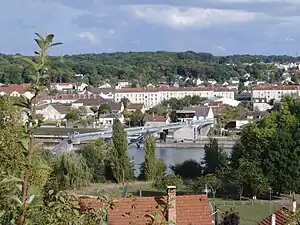 | |
| 行政 | |
| 国 |
.svg.png.webp) フランス フランス |
| 地域圏 (Région) | イル=ド=フランス地域圏 |
| 県 (département) | セーヌ=エ=マルヌ県 |
| 郡 (arrondissement) | フォンテーヌブロー郡 |
| 小郡 (canton) | モントロー=フォール=ヨンヌ小郡 |
| INSEEコード | 77079 |
| 郵便番号 | 77430 |
| 市長(任期) |
ミシェル・ゴノール[1] (2014年 - 2020年) |
| 自治体間連合 (fr) | fr:Communauté de communes Moret Seine et Loing |
| 人口動態 | |
| 人口 |
6179人 (2015年) |
| 人口密度 | 849人/km2 |
| 住民の呼称 | Champenois |
| 地理 | |
| 座標 | 北緯48度23分44秒 東経2度47分45秒 |
| 標高 |
平均:m 最低:42m 最高:111m |
| 面積 | 7.28km2 |
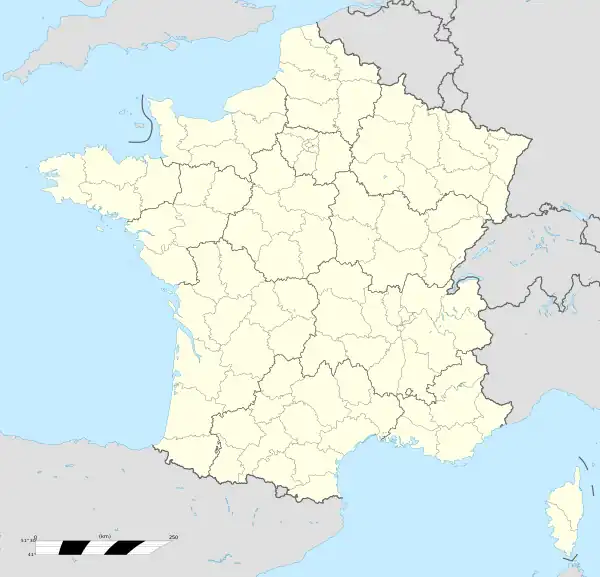  Champagne-sur-Seine | |
| 公式サイト | champagne-sur-seine.fr |
地理
コミューンはフォンテーヌブローの東9km、ブリー高原の南端にあたる、セーヌ川右岸の曲がり角に位置している。コミューン面積は北部において513ヘクタールの森林が占めている。
コミューンには鉄道駅があり、ムラン-エリシー-モントゥロー方面の路線が通る。
由来
ラテン語のcampus(平原)と、コミューン名に含まれる同名の川の名からなる。Villadque Campania dicitur、Champaigne-sur-Seine-lez-Moret-en-Gâtinois、Champaigne-lez-Sainct-Nemer、Champaigne - Champaigne-lez-Fontainebleauと移り変わった[2]。1899年9月1日の法令により、単にシャンパーニュという名だったコミューンは正式にシャンパーニュ=シュル=セーヌとなった。
人口統計
| 1962年 | 1968年 | 1975年 | 1982年 | 1990年 | 1999年 | 2004年 | 2015年 |
|---|---|---|---|---|---|---|---|
| 4837 | 5298 | 5543 | 5406 | 6092 | 6594 | 6593 | 6179 |
参照元:1962年から1999年までは複数コミューンに住所登録をする者の重複分を除いたもの。それ以降は当該コミューンの人口統計によるもの。1999年までEHESS/Cassini[3]、2006年以降INSEE[4][5]
ギャラリー
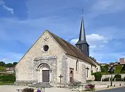 ノートル・ダム教会
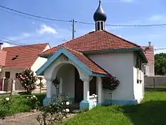 ロシア正教会の礼拝堂
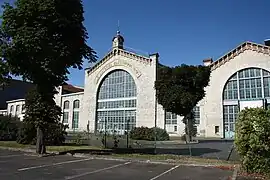 シュネデール社の旧工場建物
参照
-
"Annuaire des communes de Seine-et-Marne". um77.fr (Union des maires de Seine-et-Marne). 03/2015閲覧。
{{cite web}}:|access-date=の日付が不正です。 (説明). - "Champagne-sur-Seine". 01/2017閲覧。
{{cite web}}:|access-date=の日付が不正です。 (説明) - http://cassini.ehess.fr/cassini/fr/html/fiche.php?select_resultat=7862
- https://www.insee.fr/fr/statistiques/3293086?geo=COM-77079
- http://www.insee.fr
This article is issued from Wikipedia. The text is licensed under Creative Commons - Attribution - Sharealike. Additional terms may apply for the media files.