ジョージズ川
ジョージズ川(Georges River)は、オーストラリアのニューサウスウェールズ州東部に位置する河川。河口部は三角江になっている。
| Georges River ジョージズ川 | |
|---|---|
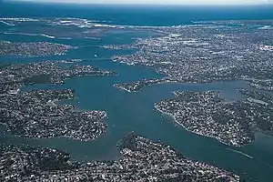 ジョージズ川下流域 | |
| 水系 | ジョージズ川 |
| 延長 | 96[1] km |
| 流域面積 | 960[1] km² |
| 水源 | アッピン(Appin) |
| 水源の標高 | 350[1] m |
| 河口・合流先 | ボタニー湾 |
| 流域 | オーストラリア, ニューサウスウェールズ |
支流
- Cabramatta Creek
- Prospect Creek
- Salt Pan Creek
- Woronora River
- チッピン・ノートン・レイクス(Chipping Norton Lakes) - チッピン・ノートン(Chipping Norton)郊外に位置する人工湖。シドニー南西部市民のレクリエーション・スポット。
橋梁
- Captain Cook Bridge (connecting Sans Souci to Taren Point),
- Tom Uglys Bridge (connecting Blakehurst to Sylvania) and
- Alfords Point Bridge (connecting Padstow Heights to Alfords Point).
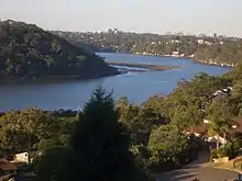
Georges River from Illawong
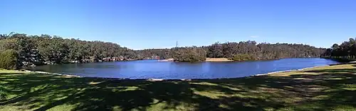
ピクニックポイント国立公園を流れるジョージズ川
名称
ジョージ3世に因んで、総督アーサー・フィリップにより名付けられる [2]。
参照
- Georges River information page, Campbelltown City Council Archived 2008年7月30日, at the Wayback Machine.
- The Book of Sydney Suburbs, Compiled by Frances Pollon, Angus & Robertson Publishers, 1990, Published in Australia ISBN 0-207-14495-8, page 107
This article is issued from Wikipedia. The text is licensed under Creative Commons - Attribution - Sharealike. Additional terms may apply for the media files.