セントラル・ロンドン
セントラル・ロンドン(Central London)はイングランド・ロンドンの都心を指すエリアであり、シティ・オブ・ロンドンおよびその隣接地域を含む[1]。道路のロンドンまでの距離は通常、チャリング・クロスを基点に計算する[2]。
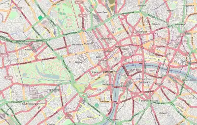
オープンストリートマップのセントラル・ロンドン地図
出典
- Mayor of London (2008年). “Central activities zone”. London Plan. Greater London Authority. 2010年5月31日時点のオリジナルよりアーカイブ。2010年3月10日閲覧。
- “OS MapZone – From where, exactly, are distances from London measured?”. Ordnance Survey. 2010年3月10日閲覧。


This article is issued from Wikipedia. The text is licensed under Creative Commons - Attribution - Sharealike. Additional terms may apply for the media files.