セント・クロア島
セント・クロア島(セント・クロアとう、フランス語: Île Sainte-Croix)は、カナダニューブランズウィック州とアメリカ合衆国メイン州の間の国境になっているセント・クロア川の河口の近くに存在するメイン州の無人の小島。
| Saint Croix Island International Historic Site | |
|---|---|
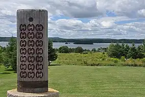 View from the New Brunswick interpretive center | |
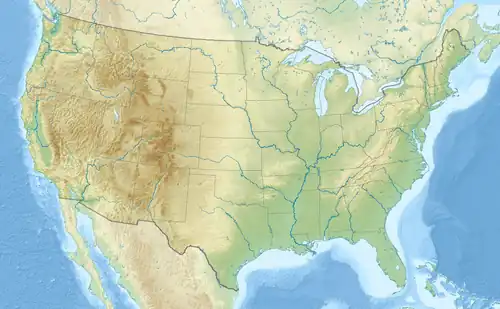  | |
| 地域 | メイン州ワシントン郡 |
| 最寄り | カレス |
| 座標 | 北緯45度7分42秒 西経67度8分0秒 |
| 面積 |
44.90エーカー (181,700 m2) 22.44エーカー (0.0908 km2) federal |
| 創立日 | June 8, 1949 (U.S. National Monument); 1968 (Cdn. National Historic Event); 1984 (International Historic Site) |
| 運営組織 | アメリカ合衆国国立公園局、パークス・カナダ |

Buildings on Saint Croix Island, 1613
地元民にはドーシェット島の名で知られており、1604年にド・モン卿ピエール・デュグァによってフランスの初期の植民活動が行われた場所である。この島は1984年にアメリカ合衆国議会により、Saint Croix Island International Historic Siteに指定された。この島に向かう公共交通機関はない。アメリカ合衆国側の本土にビジターセンターが存在し、カナダ側に掲示がある。
島の面積は6.5 acre (26,000 m2) あり、長さは約200 yd (182.9 m)、幅は100 yd (91.4 m) ある。また、Passamaquoddy Bayへのセント・クロア川の河口から4 mi (6 km) 上流に存在する。
出典
参考文献
- National Park Service (U.S.), Saint Croix Island brochure, 1990.
- National Park Service (U.S.), Saint Croix Island International Historic Site brochure, 2002.
関連項目
- ポパム植民地
- Habitation at Port-Royal
- List of islands of Maine
- National Register of Historic Places listings in Washington County, Maine
外部リンク
- Parks Canada: Saint Croix Island International Historic Site
- National Park Service: Saint Croix Island International Historic Site
- Sainte-Croix 2004
- Île Sainte-Croix
- St. Croix Island History (From the Internet Archive)
- St-Croix: 1604-2004
- Life After Ile Ste-Croix
| トピックス |
|
|---|---|
| 州の一覧 |
|
| 島嶼地域 |
|
| 自由連合国 |
|
| その他の地域 |
|
| |


This article is issued from Wikipedia. The text is licensed under Creative Commons - Attribution - Sharealike. Additional terms may apply for the media files.