バーミングハム (ミシガン州)
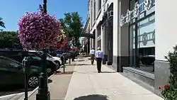
バーミングハム(英: Birmingham)は、アメリカ合衆国ミシガン州の町名。 緑が多く、自然豊か。リスや鹿、スカンクの生態が目撃される。
バーミングハム (ミシガン州) | |
|---|---|
| City of Birmingham | |
 | |
|
標語: "A Walkable Community"[1] | |
 Location of Birmingham, Michigan | |
| 座標:北緯42度32分48秒 西経83度12分41秒 | |
| 国家 | アメリカ合衆国 |
| 州 | ミシガン州 |
| 郡 | オークランド郡 |
| 設立 | 1819年 |
| 村制施行 | 1864年 |
| 市制施行 | 1932年 |
| 政府 | |
| • 種別 | Council-Manager |
| • 市長 | Mark Nickita |
| • シティーマネージャー | Joseph A. Valentine |
| 面積 | |
| • 都市 | 4.80 mi2 (12.43 km2) |
| • 陸地 | 4.79 mi2 (12.41 km2) |
| • 水域 | 0.01 mi2 (0.03 km2) 0.24% |
| 標高 | 778 ft (237 m) |
| 人口 (2010)[4] | |
| • 都市 | 20,103人 |
| • 推計 (2016)[5] | 21,007人 |
| • 密度 | 4,200人/mi2 (1,600人/km2) |
| • 都市圏 | 4,296,250人 |
| 等時帯 | UTC-5 (EST) |
| • 夏時間 | UTC-4 (EDT) |
| ZIPコード |
48009, 48012 |
| 市外局番 | 248 |
| FIPS code | 26-08640[6] |
| GNIS feature ID | 0621444[7] |
| ウェブサイト | City of Birmingham, Michigan |
地理

脚注
- “City of Birmingham, Michigan”. City of Birmingham, Michigan. 2012年8月16日時点のオリジナルよりアーカイブ。2012年8月24日閲覧。
- “US Gazetteer files 2010”. United States Census Bureau. 2011年2月20日時点のオリジナルよりアーカイブ。2012年11月25日閲覧。
- “American FactFinder”. United States Census Bureau. 2012年11月25日閲覧。
- “Population and Housing Unit Estimates”. 2017年6月9日閲覧。
- “American FactFinder”. アメリカ合衆国国勢調査局. 2013年9月11日時点のオリジナルよりアーカイブ。2008年1月31日閲覧。
- U.S. Geological Survey Geographic Names Information System: バーミングハム (ミシガン州)
- “Census of Population and Housing”. Census.gov. 2015年5月12日時点のオリジナルよりアーカイブ。2015年6月4日閲覧。
This article is issued from Wikipedia. The text is licensed under Creative Commons - Attribution - Sharealike. Additional terms may apply for the media files.