ヒルズグローヴ・カヴァード・ブリッジ
ヒルズグローヴ・カヴァード・ブリッジ(Hillsgrove Covered Bridge)は、ペンシルベニア州サリバン郡ヒルズグローヴ・タウンシップにある屋根付橋である。ロイアルソック・クリークに架かっている。1850年頃に建てられた。長さは186フィート(56.7メートル)。
| Hillsgrove Covered Bridge | |
| Rinkers Covered Bridge | |
| アメリカ合衆国国家歴史登録財 | |
 Hillsgrove Covered Bridge over Loyalsock Creek in 2008 | |
| 正式名称: Hillsgrove Covered Bridge | |
| 国 | アメリカ合衆国 |
|---|---|
| 州 | Pennsylvania |
| 郡 | Sullivan |
| 町 | Hillsgrove |
| 標高 | 880ft (268m) |
| 長さ | 186ft (57m) |
| 幅 | 18.0ft (5.5m) [1] |
| Clearance | 8.0ft (2.4m) |
| Builder | Sadler Rodgers |
| 設計 | Burr arch truss bridge |
| 原料 | Wood |
| 完成 | c. 1850 |
| - 改修 | 1963, 2001 |
| 所有・管理者 | Sullivan County |
| NBI Number | 567207035700040 |
| WGCB Number | 38-57-02 [2] |
| Load | 3 tons (2.7 t) |
| Added to NRHP | July 2, 1973 |
| NRHP Ref# | 73001666 |
| MPS | Covered Bridges of Bradford, Sullivan and Lycoming Counties TR |
 Location of the Hillsgrove Covered Bridge in Pennsylvania | |
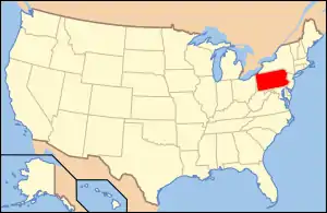 Location of Pennsylvania in the United States | |
| ウィキメディア・コモンズ: Hillsgrove Covered Bridge | |
1973年にアメリカ合衆国国家歴史登録財に登録された。サリヴァン郡の屋根付橋としては初の登録となった。
脚注
- “Pennsylvania Cultural Resources Geographic Information System” (Searchable database). Pennsylvania Historical and Museum Commission and Pennsylvania Department of Transportation. 2011年1月12日閲覧。 Note: This includes Susan M. Zacher, Pennsylvania Historical and Museum Commission. “National Register of Historic Places Inventory Nomination Form: Hillsgrove Covered Bridge” (PDF). 2008年6月4日閲覧。 Also note: This incorrectly identifies the bridge as being in Elkland Township.
- Evans, Benjamin D.; Evans, June R. (1993). Pennsylvania's Covered Bridges: A Complete Guide (1st ed.). Pittsburgh, Pennsylvania: University of Pittsburgh Press. p. 211. ISBN 0-8229-5504-0
This article is issued from Wikipedia. The text is licensed under Creative Commons - Attribution - Sharealike. Additional terms may apply for the media files.