ブラック湖 (サスカチュワン州)
ブラック湖(ブラックこ)はカナダのサスカチュワン州北部にある湖。
| Black Lake | |
|---|---|
-001.jpg.webp) | |
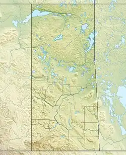  Black Lake | |
| 位置 | サスカチュワン州 |
| 座標 | 北緯59度12分00秒 西経105度15分02秒 |
| 主な流入 | フォンデュラク川、クリー川、チップマン川、 スーター川 |
| 主な流出 | フォンデュラク川 |
| 国 | カナダ |
| 延長 | 55 km (34 mi) |
| 最大幅 | 17 km (11 mi) |
| 面積 | 464 km2 (179 sq mi) |
| 水面標高 | 281 m (922 ft) |
| 島 | ファー島、ピック島など |
| 主な沿岸自治体 | ブラックレイク |
| 脚注 | [2][3] |
ウォラストン湖からのフォンデュラク川が東から注ぎ、北へ流れ出す。ブラック湖から流れ出したフォンデュラク川は西のアサバスカ湖へ注いでいる。他の流入河川はクリー湖からのクリー川、セルウィン湖からのチップマン川などがある。
コミュニティ、ブラックレイクが湖北西岸、フォンデュラク川の流出場所付近にある。
脚注
- “NASA Visible Earth (BURN SCARS IN SASKATCHEWAN, CANADA) Note: Dark to light rust coloured areas are burn scars from forest fires” (2002年8月24日). 2014年9月14日閲覧。
- “Natural Resources Canada-Canadian Geographical Names (Black Lake)”. 2014年8月29日閲覧。
- “Atlas of Canada Toporama”. 2014年8月29日閲覧。
- “Toporama - Topographic Map Sheets 74P2, 74P3, 74P4, 74P6, 74P7”. Atlas of Canada. Natural Resources Canada. 2010年8月31日時点のオリジナルよりアーカイブ。2010年2月3日閲覧。
- “Saskatchewan - Lake Areas and Elevation (lakes larger than 400 square kilometres)”. Natural Resources Canada (2009年8月12日). 2010年2月2日閲覧。
- Fish Species of Saskatchewan
This article is issued from Wikipedia. The text is licensed under Creative Commons - Attribution - Sharealike. Additional terms may apply for the media files.