ヘクター山 (ニュージーランド)
ヘクター山(英: Mount Hector)は、ニュージーランドの北島南部のタラルア山地に属する山である。標高は1,529メートル。タラルア山地には約1,300メートルから約1,500メートルの高さの山々が連なっており、ヘクター山は同山地の南部で最も標高が高いとされている[1]。
| ヘクター山 | |
|---|---|
.JPG.webp) 冬季のヘクター山 | |
| 標高 | 1,529 m |
| 所在地 |
 ニュージーランド・北島 ニュージーランド・北島 |
| 位置 | 南緯40度57分 東経175度17分 |
| 山系 | タラルア山地 |
| 初登頂 | 1895年 |
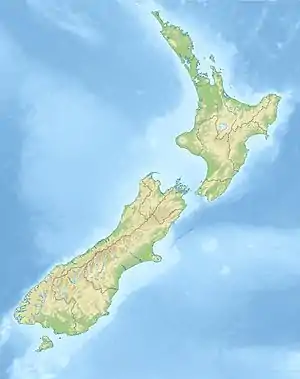  ヘクター山 | |
 プロジェクト 山 プロジェクト 山 | |
.JPG.webp)
戦没した登山家らを慰霊するための十字架
ヘクター山の名称は、19世紀のニュージーランドの科学者ジェームズ・ヘクターの姓にちなんで命名された[2]。なお、この山には第二次世界大戦の戦没者を慰霊する十字架がある[3]。
出典
- Maclean, Chris (7 March 2011) "Wellington places - Tararua Range" Te Ara - the Encyclopedia of New Zealand
- The Rutherford Journal: Places in New Zealand Named After Scientists.
- Mt Hector war memorial New Zealand history online. New Zealand Ministry for Culture and Heritage.
This article is issued from Wikipedia. The text is licensed under Creative Commons - Attribution - Sharealike. Additional terms may apply for the media files.