マイポンガ
マイポンガは、サウスオーストラリア州ヤンカリラ市の町である[7][6][1]。2016年の国勢調査によると、マイポンガには744人、うち中心部には393人居住している[3][2]。マイポンガはメイヨー選挙区、モーソン州選挙区に属している。
| マイポンガ 南オーストラリア州 | |||||||||||||||
|---|---|---|---|---|---|---|---|---|---|---|---|---|---|---|---|
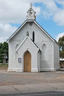 | |||||||||||||||
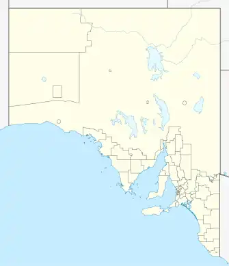  マイポンガ | |||||||||||||||
| 座標 | 南緯35度24分20秒 東経138度28分11秒[1] | ||||||||||||||
| 人口 | |||||||||||||||
| 創立 | 1858年 (分譲地) 1999年8月5日 (地方)[1] | ||||||||||||||
| 郵便番号 | 5202[4] | ||||||||||||||
| 位置 |
| ||||||||||||||
| 地域自治体 | ヤンカリラ市 | ||||||||||||||
| 地域 | フルリオ・カンガルー島[5] | ||||||||||||||
| 行政区画 | ハインドマーシュ県[1] | ||||||||||||||
| 州選挙区 | モーソン州選挙区[6] | ||||||||||||||
| 代議院選出地区 | メイヨー選挙区[7] | ||||||||||||||
| |||||||||||||||
| |||||||||||||||
| 脚注 | Locations[4] Adjoining localities[1] | ||||||||||||||
歴史
最初にこの地に移住し開拓したのは、コン・ポルデン(Con Polden)とメアリー・ウィンザー(Mary Windsor)(1840年頃)夫妻とその子であった。彼らはイングランド南西部のウィルトシャーから移住してきた。マイポンガは1858年にハンドレッドオブマイポンガ(Hundred of Myponga)の521平方マイル区画の一連の土地購入から始まり、それが集落となった事から成立した。1939年、分譲地が521平方マイル区画に造営された。地方の境界は1999年8月5日、伝統的な名前に因んで制定された[1]。
関連記事
- マイポンガ貯水池
- ニクソン・スキナー自然保護公園
- ヤルテ自然保護公園
出典
- “Search results for ‘Myponga, LOCB' with the following datasets being selected - 'Suburbs and Localities', 'Counties', 'Hundreds’, 'Local Government Areas', 'SA Government Regions’, ‘Land Development Plan Zone Categories’ and 'Gazetteer'”. Location SA Map Viewer. Government of South Australia. 2018年3月15日閲覧。
- Australian Bureau of Statistics [in 英語] (27 June 2017). "Myponga (L)". 2016 Census QuickStats. 2018年3月15日閲覧。
- Australian Bureau of Statistics [in 英語] (27 June 2017). "State Suburb of Myponga". 2016 Census QuickStats. 2018年3月15日閲覧。
- “Postcode for Myponga, South Australia”. Postcodes Australia. postcodes-australia.com. 2018年3月15日閲覧。
- “Fleurieu Kangaroo Island SA Government region”. The Government of South Australia. 2017年4月17日閲覧。
- Mawson (Map). Electoral District Boundaries Commission. 2016. 2018年3月2日閲覧。
- “Federal electoral division of Mayo, boundary gazetted 16 December 2011”. Australian Electoral Commission. 2015年8月2日閲覧。
- “Summary (climate) statistics Myponga (nearest weather station)”. Commonwealth of Australia, Bureau of Meteorology. 2019年1月14日閲覧。
This article is issued from Wikipedia. The text is licensed under Creative Commons - Attribution - Sharealike. Additional terms may apply for the media files.