マサカ
マサカ(Masaka)は、ウガンダの中央地域南西部のマサカ県の県都。人口は約11万人(2020年)。
マサカ Masaka | |
|---|---|
|
県都 | |
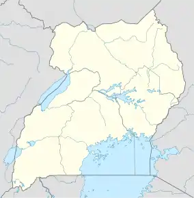  マサカ マサカの位置 | |
| 南緯00度20分28秒 東経31度44分10秒 | |
| 国 |
 ウガンダ ウガンダ |
| 地域 | 中央地域 |
| 歴史的地域 | ブガンダ |
| 県 | マサカ県 |
| 標高 | 1,200 m |
| 人口 (2020年)統計[1] | |
| • 合計 | 116,600人 |
施設等
脚注
- “City Population”. 2023年4月16日閲覧。
- “Map Showing Kampala And Masaka With Distance Marker”. Globefeed.com. 2014年4月17日閲覧。
- Google Maps – Location of Masaka At Google Maps (Map). Cartography by Google, Inc. Google, Inc. 2015年7月1日閲覧。
- “Estimated Population of Masaka In 2002, 2010 & 2011”. Uganda Bureau of Statistics. 2014年4月17日閲覧。
- UBOS (2014年8月27日). “The Population of The Regions of the Republic of Uganda And All Cities And Towns of More Than 15,000 Inhabitants”. Citypopulation.de Quoting Uganda Bureau of Statistics (UBOS). 2015年2月22日閲覧。
- “Location of Lake Nabugabo”. Lake Nabugabo Resort. 2014年4月17日閲覧。
- “Bank of Uganda Maintains A Currency Center In Masaka”. Bank of Uganda. 2014年4月17日閲覧。
外部リンク
- Masaka Town Expands To Get City Status
- Lake Nabugabo Homepage
- Masaka District Internet Portal
- River Of Life Church & Orphanage
- Uganda International Marathon, Masaka
- 写真
This article is issued from Wikipedia. The text is licensed under Creative Commons - Attribution - Sharealike. Additional terms may apply for the media files.