マッキャナイダードーホーリア
マッキャナイダードーホーリア(愛: Muiceanach idir Dhá Sháile[1]、英: Muckanaghederdauhaulia)はアイルランドのゴールウェイ県コネマラ、ゲールタハトのキャマスとキャラローの間にある村。この地名はアイルランド語で最長の地名であると同時にあらゆる言語においてアイルランドの地名の中で最長であるといわれている[2]。
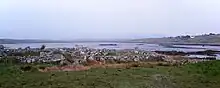
マッキャナイダードーホーリアの海岸
概要
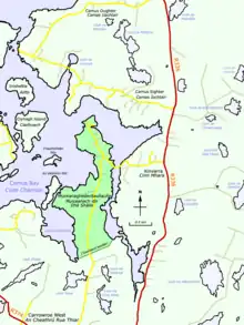
マッキャナイダードーホーリアの地図
マッキャナイダードーホーリアは、「二つの海の間のブタ型の丘」の意味する[3]。
村内には、アイルランド語で同じ名前(Muiceanach idir Dhá Sháile)を持つ村落があったが、英語では短い名前、のマックナサリア(Mucknasalia)が使用されていた[4][5]。1911年の国勢調査では「Muckenaghedderdahaulia」(23文字)と綴られていたが、公表された報告書では22文字の綴りになっている[6][7]。
カミュス・ベイの低い湿った半島にあり、キン・ハラで地方道R336号の道路を西に曲がるか、カスラを出て地方道R374号の道路を北西に進み、スクラトグ通りで曲がり北上することで行くことができる[8]。
人口
国勢調査で記載されているものには、以下のような人口が記録されている[9][7]。
| 国勢調査年 | 1841年 | 1851年 | 1861年 | 1871年 | 1881年 | 1891年 | 1901年 | 1911年 |
|---|---|---|---|---|---|---|---|---|
| 人口 | 103人 | 81人 | 79人 | 80人 | 111人 | 85人 | 101人 | 111人 |
大衆文化
ジョルジュ・ペレックの小説『人生使用法』の中で、この地域について言及されている[10]。
脚注
出典
- Muckanaghederdauhaulia at the Irish Placenames Database. Retrieved: 2010-09-30.
- Gerry Coughlan & Martin Hughes. Irish Language and Culture. Lonely Planet, 2007. Page 213.
- Ó Máille, T. S. (1955). “Muiceanach Mar Áitainm” (Irish, English). Journal of the Royal Society of Antiquaries of Ireland (Royal Society of Antiquaries of Ireland) 85 (1): 88–93. JSTOR 25509201.
- “Mucknasalia”. Placenames Database of Ireland. 2013年11月13日閲覧。
- “First-edition 6-inch map”. Mapviewer. Ordnance Survey Ireland (c. 1840). 2013年11月13日閲覧。
- “Houses in Muckenaghedderdahaulia (Crumpaun, Galway)”. Census of Ireland 1911. National Archives. 2013年11月13日閲覧。
- “Census > 1911 > Ireland > Area, houses, and population, Connaught, Ireland, 1911 Page 86”. HISTPOP.ORG. 2013年11月13日閲覧。
- Muckanaghederdauhaulia Google Maps. Retrieved: 2013-11-12.
- “Census > 1881 > Ireland > Area, population and number of houses, Vol. IV, Ireland, 1881 Page 96”. HISTPOP.ORG. 2013年11月13日閲覧。
- Perec, Georges (2008). Life: A User's Manual. London: Vintage. pp. 52. ISBN 9780099449256


This article is issued from Wikipedia. The text is licensed under Creative Commons - Attribution - Sharealike. Additional terms may apply for the media files.