マハーバレーシュワル
マハーバレーシュワル( 発音、マラーティー語:महाबळेश्वर、英語:Mahabaleshwar)は、インドのマハーラーシュトラ州、サーターラー県の都市。
マハーバレーシュワル Mahabaleshwar महाबळेश्वर | |
|---|---|
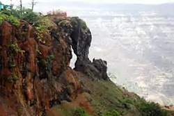 マハーバレーシュワルの渓谷 | |
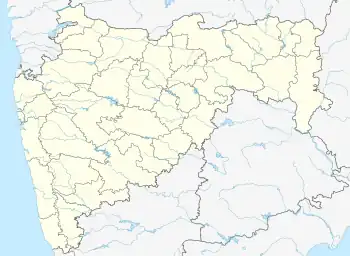  マハーバレーシュワル Mahabaleshwar | |
| 北緯17.54度 東経73.91度 | |
| 国 |
 インド インド |
| 州 | マハーラーシュトラ州 |
| 県 | サーターラー県(Satara District) |
| 面積 | |
| • 合計 | 137.15 km2 |
| 標高 | 1,353 m |
| 人口 (2011)[1] | |
| • 合計 | 12,737人 |
| • 密度 | 93人/km2 |
| 言語 | |
| • 公用語 | マラーティー語 |
| 等時帯 | UTC+5:30 (インド標準時(IST)) |
| 男女比 | 90 females/ 100 males ♂/♀ |
| 識字率 | 78% |
歴史
詳細は「en:Mahabaleshwar#History」を参照
14世紀、デカンを支配したバフマニー朝の支配下にあり、16世紀初頭まで

気候
| Mahabaleshwarの気候 | |||||||||||||
|---|---|---|---|---|---|---|---|---|---|---|---|---|---|
| 月 | 1月 | 2月 | 3月 | 4月 | 5月 | 6月 | 7月 | 8月 | 9月 | 10月 | 11月 | 12月 | 年 |
| 平均最高気温 °C (°F) | 23.6 (74.5) |
25.6 (78.1) |
28.6 (83.5) |
29.9 (85.8) |
28.8 (83.8) |
21.6 (70.9) |
18.7 (65.7) |
18.8 (65.8) |
19.9 (67.8) |
24.0 (75.2) |
23.8 (74.8) |
23.1 (73.6) |
23.87 (74.96) |
| 平均最低気温 °C (°F) | 8.9 (48) |
12.6 (54.7) |
17.4 (63.3) |
18.9 (66) |
18.2 (64.8) |
17.0 (62.6) |
16.8 (62.2) |
16.4 (61.5) |
15.8 (60.4) |
16.3 (61.3) |
14.1 (57.4) |
11.8 (53.2) |
15.35 (59.62) |
| 降水量 mm (inch) | 4.6 (0.181) |
2.8 (0.11) |
4.6 (0.181) |
25.1 (0.988) |
47.0 (1.85) |
939.8 (37) |
2,546.1 (100.24) |
1,764.3 (69.461) |
685.8 (27) |
154.4 (6.079) |
46.5 (1.831) |
5.3 (0.209) |
6,226.3 (245.13) |
| 出典:Government of Maharashtra | |||||||||||||
人口統計
2011年の統計では、マハーバレーシュワルの人口は12,737人[1]。 男女比は男性が55%、女性は45%、全体に対する6歳以下の占める割合は11%である。
都市別の平均識字率は78%と国の平均74.04%より高く、うち男性識字率は84%、女性識字率は71%となっている。
交通
詳細は「en:Mahabaleshwar#Transport」を参照
出典
- “Census of India 2001: Data from the 2001 Census, including cities, villages and towns (Provisional)”. Census Commission of India. 2004年6月16日時点のオリジナルよりアーカイブ。2008年11月1日閲覧。
- “Falling Rain Genomics, Inc - Mahabaleshwar”. 2007年11月29日閲覧。
関連項目
This article is issued from Wikipedia. The text is licensed under Creative Commons - Attribution - Sharealike. Additional terms may apply for the media files.