マバルマ
マバルマ(英語: Mabaruma)はガイアナのバリマ=ワイニ州の州都[3]。アルカ川の近く、標高13メートルの周囲の熱帯雨林の上の狭い高原に位置し、ベネズエラとの国境が近い。2012年国勢調査によれば人口は1,254人で、人種別だと混血、次いでアメリカ先住民が多い[2]。
| マバルマ Mabaruma | |
|---|---|
 | |
| 位置 | |
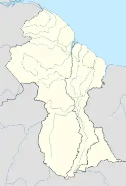  マバルマ マバルマ (ガイアナ) | |
| 座標 : 北緯8度12分0秒 西経59度47分0秒 | |
| 行政 | |
| 国 |  ガイアナ ガイアナ |
| 州 | バリマ=ワイニ州 |
| 基礎自治体 | マバルマ=クマカ=ホソロロ |
| 町 | マバルマ |
| 町長 | トレヴィ・レオン[1] |
| 人口 | |
| 人口 | (2012年現在) |
| 町域 | 1,254人 |
| 備考 | [2] |
| その他 | |
| 等時帯 | UTC-4 |
周辺の村と共にマバルマ=クマカ=ホソロロ(Mabaruma / Kumaka / Hosororo)基礎自治体(町)に属している。以前はNDC(近隣民主評議会)であったが[4]、2016年に町へ格上げされた[5]。1965年に創立された地域初の中等学校であるノースウェスト中学校がある[6]。
歴史
かつてはブルームズ家が所有していた土地で、ココアが栽培されていた。ガイアナ政府は政府機関を建設するために土地の一部を購入した。
数キロ下流に位置するモラワンナが川の洪水の危機にさらされると、モラワンナに代わって行政府所在地に選ばれた[7]。1958年以降は北西部県の県都として、1980年の行政区画再編後はバリマ=ワイニ州の州都として機能している[8]。
2023年12月にベネズエラがエセキボ地域を自国領だと宣言すると、マバルマの市民グループは集会を開き、マバルマはガイアナ領であると宣言した[9]。一方でベネズエラの軍事侵攻を恐れて避難する住人もいた[10]。
気候
| Mabarumaの気候 | |||||||||||||
|---|---|---|---|---|---|---|---|---|---|---|---|---|---|
| 月 | 1月 | 2月 | 3月 | 4月 | 5月 | 6月 | 7月 | 8月 | 9月 | 10月 | 11月 | 12月 | 年 |
| 平均最高気温 °C (°F) | 28.9 (84) |
29.3 (84.7) |
29.7 (85.5) |
30.3 (86.5) |
30.0 (86) |
29.3 (84.7) |
29.6 (85.3) |
30.5 (86.9) |
31.1 (88) |
31.2 (88.2) |
30.4 (86.7) |
29.7 (85.5) |
30 (86) |
| 日平均気温 °C (°F) | 25.2 (77.4) |
25.5 (77.9) |
25.8 (78.4) |
26.4 (79.5) |
26.5 (79.7) |
26.1 (79) |
26.0 (78.8) |
26.5 (79.7) |
26.9 (80.4) |
27.0 (80.6) |
26.4 (79.5) |
26.0 (78.8) |
26.19 (79.14) |
| 平均最低気温 °C (°F) | 21.6 (70.9) |
21.7 (71.1) |
22.0 (71.6) |
22.6 (72.7) |
23.0 (73.4) |
22.9 (73.2) |
22.5 (72.5) |
22.6 (72.7) |
22.7 (72.9) |
22.8 (73) |
22.5 (72.5) |
22.4 (72.3) |
22.44 (72.4) |
| 雨量 mm (inch) | 222 (8.74) |
112 (4.41) |
108 (4.25) |
149 (5.87) |
293 (11.54) |
394 (15.51) |
331 (13.03) |
269 (10.59) |
189 (7.44) |
193 (7.6) |
251 (9.88) |
328 (12.91) |
2,839 (111.77) |
| 出典:Climate-Data.org[11] | |||||||||||||
出典
- “Mayors, deputies sworn in”. Stabroek News. (2023年8月8日) 2024年2月26日閲覧。
- “2012 Population by Village”. Statistics Guyana. 2023年12月28日閲覧。
- “Regional Democratic Councils”. Ministry of Local Government and Regional Development. 2023年12月26日閲覧。
- “Councils of Guyana”. Statoids (2012年4月26日). 2023年12月28日閲覧。
- “The development of towns goes beyond mere speeches and promises”. Stabroek News. (2016年3月10日) 2023年12月28日閲覧。
- “Mabaruma”. Stabroek News. (2016年10月23日) 2023年12月28日閲覧。
- “Morawhanna”. Stabroek News. (2012年4月8日) 2023年12月28日閲覧。
- “Regions of Guyana”. Statoids (2015年11月5日). 2023年12月28日閲覧。
- “Guyanese rally for Essequibo”. Trinidad Express. (2023年12月21日) 2023年12月28日閲覧。
- “Residents flee as fear grips border town”. Trinidad Express. (2023年12月2日) 2023年12月28日閲覧。
- “Climate: Mabaruma”. Climate-Data.org. 2020年8月13日閲覧。
This article is issued from Wikipedia. The text is licensed under Creative Commons - Attribution - Sharealike. Additional terms may apply for the media files.