モンテ・タマロ
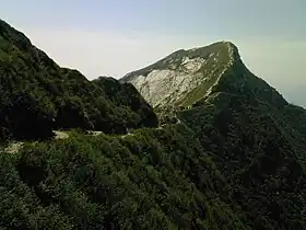
モンテ・タマロ(Monte Tamaro) は、スイスの行政区ティチーノ州で、マッジョーレ湖を見下ろす[3]、ルガーノプレアルプス山脈の山。
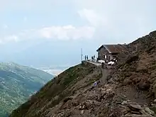
標高1867m地点の山小屋
| モンテ・タマロ | |
|---|---|
 | |
| 最高地点 | |
| 標高 | 1,962 m (6,437 ft) |
| プロミネンス | 1,408 m (4,619 ft) [1] |
| アイソレーション | 13.3 km (8.3 mi) [2] |
| 座標 | 北緯46度06分14.1秒 東経8度51分57.7秒 |
| 地形 | |
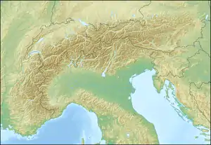  モンテ・タマロ アルプス山脈における位置 | |
| 所在地 | ティチーノ州, スイス |
| 所属山脈 | 西アルプス山脈 |
| 登山 | |
| 最容易 ルート | 索道 and trail to the summit |
 プロジェクト 山 プロジェクト 山 | |
標高は1,962m。マッジョーレ湖と、モンテ・レマを含むルガーノ湖の間に位置する、ティチーノ州の最高峰で最も顕著な山である。麓の街リヴェラから、ケーブルカーで標高1,530m地点にある、世界的に有名な建築家・マリオ・ボッタが設計したサンタ・マリア・デリ・アンジェリ教会や展望台のあるアルプフォッパまで行くことが出来る。頂上からモンテ・レマまで、5時間弱で縦走できるコースも知られている。
脚注
- Retrieved from the Swisstopo topographic maps. The key col is the Monte Ceneri Pass (554 m).
- Retrieved from Google Earth. The nearest point of higher elevation is south of the Cima dell'Uomo.
- 秋いっぱいのスイス
This article is issued from Wikipedia. The text is licensed under Creative Commons - Attribution - Sharealike. Additional terms may apply for the media files.