モンペルー (ピュイ=ド=ドーム県)
モンペルー (Montpeyroux)は、フランス、オーヴェルニュ=ローヌ=アルプ地域圏、ピュイ=ド=ドーム県のコミューン。
| Montpeyroux | |
|---|---|
.svg.png.webp) .JPG.webp) | |
| 行政 | |
| 国 |
.svg.png.webp) フランス フランス |
| 地域圏 (Région) | オーヴェルニュ=ローヌ=アルプ地域圏 |
| 県 (département) |
ピュイ=ド=ドーム県 |
| 郡 (arrondissement) | イソワール郡 |
| 小郡 (canton) | ヴィック=ル=コント小郡 |
| INSEEコード | 63241 |
| 郵便番号 | 63114 |
| 市長(任期) |
クリストフ・ロシェット[1] (2014年-2020年) |
| 自治体間連合 (fr) | fr:Communauté de communes Couze Val d'Allier |
| 人口動態 | |
| 人口 |
351人 (2012年) |
| 人口密度 | 107人/km2 |
| 地理 | |
| 座標 | 北緯45度37分25秒 東経3度12分18秒 |
| 標高 |
平均:m 最低:342m 最高:484m |
| 面積 | 3.29km2 |
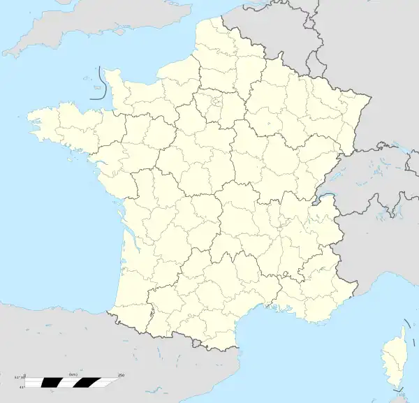  Montpeyroux | |
| 公式サイト | montpeyroux63.com |
クレルモン=フェラン都市圏の一部であり、フランスの最も美しい村の1つである[2]・[3]。
歴史
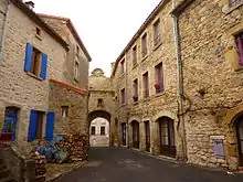
モンペルーの典型的な通り
この小さな山の上の村は、13世紀のドンジョンのシルエットに支配されている。石はかつてモンペルーで切り出されていた花崗砂岩で、地元での建設資材として広く用いられていた。その暖かみのあるブロンド色の石は、イソワールの修道院を含む、アリエ川谷沿いの多くのロマネスク様式教会で見つけることができる。
コミューンとしてのモンペルーは、1889年にクードより分割されて誕生した[4]。
人口統計
| 1962年 | 1968年 | 1975年 | 1982年 | 1990年 | 1999年 | 2006年 | 2012年 |
|---|---|---|---|---|---|---|---|
| 324 | 282 | 284 | 262 | 303 | 329 | 352 | 351 |
史跡
_tour_du_ch%C3%A2teau_(2).JPG.webp) ドンジョン
ドンジョン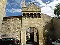 城門
城門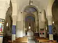 教会
教会
- モンペルー城跡 - 12世紀の塔からは、西から北西に広がるシェーヌ・デ・ピュイ(ピュイ・ド・サンシーやピュイ・ド・ドーム)、および南側のイソワールの方向にあるアリエ川谷の近くの村々を眺める。
- 14世紀の城門 - 城と中世の村を取り囲んでいた城壁の跡
脚注
- Liste des maires 2014, site de la préfecture du Puy-de-Dôme (consulté le 28 septembre 2014).
- Zonage en aires urbaines 2010 de Clermont-Ferrand (019) sur le site de l'Insee, consulté le 5 novembre 2013.
- Fiche de Montpeyroux sur le site Les Plus Beaux Villages de France, consulté le 20 octobre 2013.
- http://cassini.ehess.fr/cassini/fr/html/fiche.php?select_resultat=23746
- http://www.statistiques-locales.insee.fr
- http://www.insee.fr
This article is issued from Wikipedia. The text is licensed under Creative Commons - Attribution - Sharealike. Additional terms may apply for the media files.