モートン湾
モートン湾(Moreton Bay)は、ブリスベン(クイーンズランド州、オーストラリア)東19kmに位置する湾。魚釣りの行楽地、港湾(ブリスベン港)として機能している。
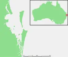
モートン湾の位置
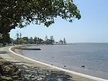
マンリーのビーチ
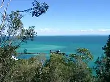
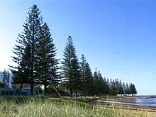
スカボローの風景
歴史
- 約6000年前、氷期終焉時の海面上昇による湾の形成
- 1770年5月15日、ジェームズ・クックはこの地域を通過した際に、王立協会長モートン卿に因んでモートン湾(Moreton Bay)と命名。モートン卿の名前は Morton であるが、クックの最初の航海記に現在の Moreton で記されているのはスペルミスだと考えられている[1]。 (Hawkesworth's Voyages[2])
- 1799年、マシュー・フリンダースはヨーロッパ人で最初に湾内を調査。
- 1823年、ジョン・オクスリーはブリスベン川を調査。受刑者、兵士が上陸。
- 1824年、オクスレイはモートン湾地域で最初の植民地を設置。
- 1830年代、ヨーロッパ人と先住民族(クアンダムーカ族)の争い、ヨーロッパ人の銃によりアボリジニーを虐殺した[3] 。
- 1850年代までは材木輸送の港として機能していた。
地理
脚注
- Ray Parkin, H. M. Bark Endeavour, Miegunyah Press, second edition 2003, ISBN 0-522-85093-6, page 226.
- Voyages in the Southern Hemisphere, John Hawkesworth, 1773, volumes II-III, page 513 (online at the National Library of Australia).
- Evans, Raymond (2007). A History of Queensland. Port Melbourne, Victoria: Cambridge University Press. pp. 46. ISBN 9780521876926
- "Four dead, 10 injured after boat collision". ABC News Online, 1 September, 2007
- “Moreton Bay | Ramsar Sites Information Service”. rsis.ramsar.org (1999年1月1日). 2024年3月3日閲覧。
外部リンク
- Bribie Island Tourism and Business Directory
- Moreton Bay Database - a detailed chronicle of events
- BayJournal An online news source publishing one story a day about the Bay.
- Raby Bay Weather Station A weather station on the shores of Moreton Bay with links to all things weather.
- Folk song about the penal colony at Moreton Bay
- Pencil drawing of Moreton Bay settlement, ca. 1835 by Henry Boucher Bowerman. Digitised and held by Heritage Collections, State Library of Queensland.
This article is issued from Wikipedia. The text is licensed under Creative Commons - Attribution - Sharealike. Additional terms may apply for the media files.