ランギトト島
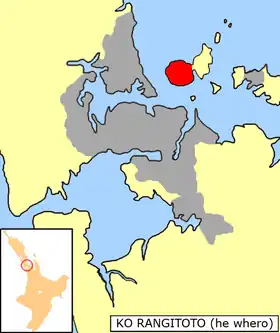
ランギトト島(英: Rangitoto Island)は、ニュージーランド北島のハウラキ湾に浮かぶ面積約23km2の火山島である。
| ランギトト島 | |
|---|---|
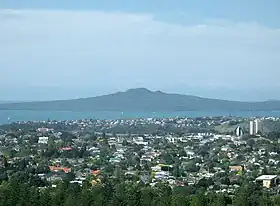 ヴィクトリア山から見たランギトト島 | |
| 所在地 |
 ニュージーランド ニュージーランド |
| 所在海域 | ハウラキ湾 |
| 座標 | 南緯36度47分16秒 東経174度51分29秒 |
| 面積 | 23 km² |
| 最高標高 | 260 m |
 | |
 プロジェクト 地形 プロジェクト 地形 | |
概要
面積約23km2、幅約5.5kmで、最高標高は260m。オークランドとはランギトト海峡で隔てられている。オークランド火山群に属する楯状火山であり、約620年前と570年前に噴火した[1]。最後の噴火までの約1000年間、断続的に噴火していたとみられる[2]。
森林に覆われており、多数の固有種や絶滅危惧種が生息している。 1890年に自然保護区となった[3]。
太平洋戦争中にアメリカ軍がこの島に軍事施設を建設した。島の北岸は不要な船の難破地として使用され、干潮時にはいくつかの難破船の残骸を見ることができる。
ギャラリー
.jpg.webp) 森林
森林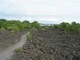 溶岩原
溶岩原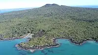 南から見たランギトト島
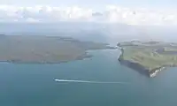 ランギトト島(左)とモツタプ島
脚注
- “Global Volcanism Program | Auckland Volcanic Field” (英語). Smithsonian Institution | Global Volcanism Program. 2024年4月13日閲覧。
- Shane, Phil; Gehrels, Maria; Zawalna-Geer, Aleksandra; Augustinus, Paul; Lindsay, Jan; Chaillou, Isabelle (2013-05-01). “Longevity of a small shield volcano revealed by crypto-tephra studies (Rangitoto volcano, New Zealand): Change in eruptive behavior of a basaltic field”. Journal of Volcanology and Geothermal Research 257: 174–183. doi:10.1016/j.jvolgeores.2013.03.026. ISSN 0377-0273.
- Wong, KL Clara; O'Shea, Steve (2010-09). “Sediment macrobenthos off eastern Waiheke Island, Hauraki Gulf, New Zealand”. New Zealand Journal of Marine and Freshwater Research 44 (3): 149–165. doi:10.1080/00288330.2010.498088. ISSN 0028-8330.
- “Rangitoto | New Zealand Geographic”. web.archive.org (2016年6月11日). 2024年4月13日閲覧。
関連項目
- ニュージーランドの火山一覧
- ニュージーランドの火山活動
外部リンク
- ランギトト島景観保護区 - 自然保護省
- ランギトト島自然保護トラスト
This article is issued from Wikipedia. The text is licensed under Creative Commons - Attribution - Sharealike. Additional terms may apply for the media files.