レインワウデ
レインワウデ(オランダ語: Rijnwoude)は、オランダ西部の南ホラント州にかつて存在した基礎自治体(ヘメーンテ)。
レインワウデ | |
|---|---|
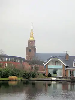 レインワウデの教会 | |
.svg.png.webp) | |
| 北緯52度8分 東経4度35分 | |
| 国 | オランダ |
| 州 | 南ホラント州 |
| 設置 | 1991年1月1日 |
| 解散 | 2014年1月1日[1] |
| 面積 | |
| • 合計 | 57.89 km2 |
| • 陸地 | 56.69 km2 |
| • 水域 | 1.20 km2 |
| 標高 | −1 m |
| 人口 (2013年11月)[4] | |
| • 合計 | 18,523人 |
| • 密度 | 327人/km2 |
| 等時帯 | UTC+1 (中央ヨーロッパ標準時) |
| • 夏時間 | UTC+2 (中央ヨーロッパ夏時間) |
| 郵便番号 |
2390–2396, 2730–2731 |
| 市外局番 | 0172, 071, 079 |
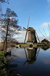
ハゼルスワウデ=ドルプの近くにあるリートフェルドセ・モレンの風車
人口は1万8523人(2013年)。面積は57.89km2で、このうち1.20km2が水域であった。
1991年にそれまでのベントホイゼン (Benthuizen) 、ハゼルスワウデ (Hazerswoude) 、カウデケルク・アーン・デン・レイン (Koudekerk aan den Rijn) の各ヘメーンテが合併し、レイネフェルト (Rijneveld) として設置され、1993年にレインワウデに改称された。2014年に解散され、アルフェン・アーン・デン・レインに編入された。
ベントホルン (Benthorn) 、ベントホイゼン、ハゼルスワウデ=ドルプ (Hazerswoude-Dorp) 、フルネンデイク (Groenendijk) 、ハゼルスワウデ=レインデイク (Hazerswoude-Rijndijk) 、ホヘフェーン (Hogeveen) 、カウデケルク・アーン・デン・レインの各コミュニティからなっていた。市庁舎はハゼルスワウデ=レインデイクにあった。
脚注
- “Gemeentelijke indeling op 1 januari 2014” [Municipal divisions on 1 January 2014] (Dutch). cbs.nl. CBS. 2014年1月10日閲覧。
- “Kerncijfers wijken en buurten” [Key figures for neighbourhoods] (Dutch). CBS Statline. CBS (2013年7月2日). 2013年7月11日閲覧。
- “Postcodetool for 2394EB” (Dutch). Actueel Hoogtebestand Nederland. Het Waterschapshuis. 2013年8月19日閲覧。
- “Bevolkingsontwikkeling; regio per maand” [Population growth; regions per month] (Dutch). CBS Statline. CBS (2013年12月23日). 2014年1月20日閲覧。
This article is issued from Wikipedia. The text is licensed under Creative Commons - Attribution - Sharealike. Additional terms may apply for the media files.