ロアイタ礁
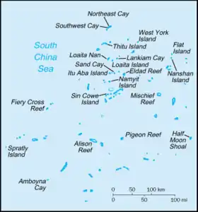
ロアイタ礁(英語: Loaita Cay、タガログ語: Melchora Aquino Cay、ベトナム語: Đá Đảo Loại Ta Tây、中国語: 双黄沙洲)は、南沙諸島のロアイタ堆(英語: Loaita Bank、中国語: 道明群礁)の南西端に位置する砂堆である。
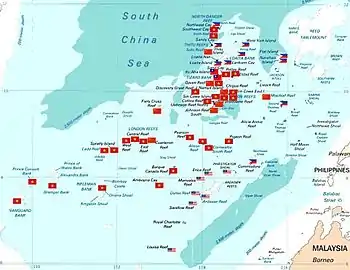
南沙諸島の実効支配状況
脚注
- D. J. Hancox、John Robert Victor Prescott (1995). A Geographical Description of the Spratly Islands and an Account of Hydrographic Surveys Amount Those Islands. International Boundaries Research Unit, University of Durham
関連項目
外部リンク
南沙諸島(スプラトリー諸島) | ||||||||||||||
|---|---|---|---|---|---|---|---|---|---|---|---|---|---|---|
| 北中部 (多国支配) |
|  | ||||||||||||
| 北東部 (主にフィリピン支配) |
| |||||||||||||
| 南西部 (主にベトナム支配) |
| |||||||||||||
| 中南部 (主にマレーシア支配) |
| |||||||||||||
 カテゴリ カテゴリ | ||||||||||||||
This article is issued from Wikipedia. The text is licensed under Creative Commons - Attribution - Sharealike. Additional terms may apply for the media files.