アガゴ県
アガゴ県(アガゴけん、英語:Agago District)はウガンダの北部地域中部の県。 県都はアガゴ。 2014年の人口は22万7486人。
アガゴ県 Agago District Wilaya ya Agago | |
|---|---|
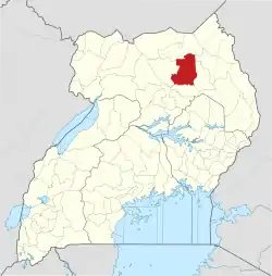 アガゴ県の位置 | |
| 国 |
 ウガンダ ウガンダ |
| 地域 | 北部地域 |
| 歴史的地域 | アチョリ地方 |
| 新設 | 2010年7月1日 |
| 県都 | アガゴ |
| 面積 | |
| • 合計 | 3,496.8 km2 |
| 標高 | 1,060 m |
| 人口 (2014年) | |
| • 合計 | 227,486人 |
| • 密度 | 65.1人/km2 |
| 等時帯 | UTC+3 (EAT) |
| ISO 3166コード | UG-322 |
| ウェブサイト |
www |
脚注
- “Approximate Road Distance Between Kitgum And Agago With Map”. Globefeed.com. 2014年5月24日閲覧。
- “Map Showing Kampala And Agago With Distance Marker”. Globefeed.com. 2014年5月24日閲覧。
- “Estimated Population of Agago District In 1991, 2002 & 2012”. Citypopulation.de. 2014年5月24日閲覧。

This article is issued from Wikipedia. The text is licensed under Creative Commons - Attribution - Sharealike. Additional terms may apply for the media files.