アバルア
| アバルア Avarua | |
|---|---|
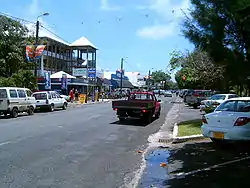 アバルアのメインストリート | |
| 位置 | |
_map.png.webp) | |
| 位置 | |
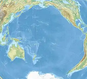  アバルア アバルア (太平洋)  アバルア アバルア (クック諸島) | |
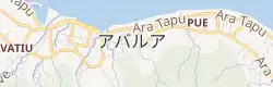 | |
| 座標 : 南緯21度12分24秒 西経159度46分31秒 | |
| 行政 | |
| 国 |  クック諸島 クック諸島 |
| 島 | ラロトンガ島 |
| 町 | アバルア |
| 地理 | |
| 面積 | |
| 町域 | 67.39 km2 (26.02 mi2) |
| 人口 | |
| 人口 | (2016年現在) |
| 町域 | 4,906人 |
| 人口密度 | 201.73人/km2(32.46人/mi2) |
| その他 | |
| 等時帯 | UTC-10 |
クック諸島のラロトンガ島の北海岸に位置し、人口は約4,906人である[1]。小さな町だが、クック諸島の中では一番人口が多い町で、役所や銀行などがある。ラロトンガ国際空港があり、クック諸島の玄関口となっている。
気候
| アバルアの気候 | |||||||||||||
|---|---|---|---|---|---|---|---|---|---|---|---|---|---|
| 月 | 1月 | 2月 | 3月 | 4月 | 5月 | 6月 | 7月 | 8月 | 9月 | 10月 | 11月 | 12月 | 年 |
| 平均最高気温 °C (°F) | 27.8 (82) |
28.9 (84) |
28.9 (84) |
27.8 (82) |
27.2 (81) |
26.1 (79) |
25.0 (77) |
25.0 (77) |
25.0 (77) |
26.1 (79) |
27.2 (81) |
27.2 (81) |
26.9 (80.4) |
| 日平均気温 °C (°F) | 26.1 (79) |
26.7 (80.1) |
26.7 (80.1) |
25.6 (78.1) |
24.4 (75.9) |
22.8 (73) |
22.8 (73) |
22.8 (73) |
22.8 (73) |
23.3 (73.9) |
24.4 (75.9) |
25.0 (77) |
24.4 (75.9) |
| 平均最低気温 °C (°F) | 23.9 (75) |
23.9 (75) |
23.9 (75) |
22.8 (73) |
22.2 (72) |
20.0 (68) |
20.0 (68) |
20.0 (68) |
20.0 (68) |
21.1 (70) |
22.2 (72) |
22.8 (73) |
21.9 (71.4) |
| 降水量 mm (inch) | 190 (7.48) |
190 (7.48) |
190 (7.48) |
170 (6.69) |
140 (5.51) |
80 (3.15) |
60 (2.36) |
70 (2.76) |
80 (3.15) |
80 (3.15) |
130 (5.12) |
160 (6.3) |
1,540 (60.63) |
| 平均降水日数 | 19 | 17 | 19 | 18 | 17 | 16 | 15 | 15 | 15 | 15 | 14 | 17 | 197 |
| % 湿度 | 85 | 85 | 85 | 85 | 85 | 80 | 80 | 80 | 80 | 80 | 80 | 85 | 82.5 |
| 平均日照時間 | 7 | 8 | 8 | 9 | 10 | 11 | 10 | 11 | 12 | 12 | 10 | 8 | 9.7 |
| 出典:Weatherbase[2] | |||||||||||||
出典
- Hassall, Graham; Tipu, Feue (28 April 2008). “Local Government in the South Pacific Islands”. Commonwealth Journal of Local Governance (1): 7–29. doi:10.5130/cjlg.v1i0.766 2017年5月2日閲覧。.
- “Avarua, Cook Islands Travel Weather Averages (Weatherbase)”. 2019年10月27日閲覧。

This article is issued from Wikipedia. The text is licensed under Creative Commons - Attribution - Sharealike. Additional terms may apply for the media files.