クアンド・クバンゴ州
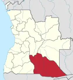
クアンド・クバンゴ州(クアンド・クバンゴしゅう、ポルトガル語:Cuando Cubango、ムブンドゥ語: Kuando Kubango)は、アンゴラの一つ州、2番目に大きな州である。アンゴラの南東端に位置し、首都ルアンダから州都メノングエまで約1000キロ、ナミビアとザンビアと国境を接している。名前は東側のクアンド川と西側のクバンゴ川に由来し、同国で“地の果ての土地”と呼ばれている。
クアンド・クバンゴ州 Província do Cuando Cubango | |
|---|---|
 | |
| 国 |
 アンゴラ アンゴラ |
| 州都 | メノングエ |
| 面積 | |
| • 合計 | 204,000 km2 |
| 人口 (2014年現在)[1] | |
| • 合計 | 534,002人 |
| • 密度 | 2.6人/km2 |
| 等時帯 | UTC+1 (WAT) |
| ISO 3166コード | AO-CCU |
| HDI (2018) |
0.498[2] low · 16th |
| ウェブサイト |
www |
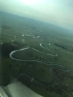
クアンド・クバンゴ州
アンゴラ内戦の中で、この州は南アフリカからの侵略により、最も激しい戦いをもたらした。今までマビンガやメノングエ、クイト・クアナバルを中心に地雷がまだ多く残っている[3]。
脚注
- “Resultados Definitivos Recenseamento Geral da População e Habitação - 2014”. Instituto Nacional de Estatística, República de Angola. 2020年5月3日閲覧。
- “Sub-national HDI - Area Database - Global Data Lab” (英語). hdi.globaldatalab.org. 2020年2月27日閲覧。
- クアンド・クバンゴ州
関連項目
外部リンク
- Official website of province governor
- Information on this province at the Angolan ministry for territorial administration
- Information on this province at Info Angola
- Site Official de Kizomba
- United States government population statistics from 1988
- angola.org.uk
- Province geographical info at geoview.info
This article is issued from Wikipedia. The text is licensed under Creative Commons - Attribution - Sharealike. Additional terms may apply for the media files.