パヴォニス山
パヴォニス山(英: Pavonis Mons)は、火星の赤道近辺のタルシス台地にあるタルシス三山のうち中央にある火山。
 パヴォニス山 | |
| 種類 | 火山 |
|---|---|
| 天体 |
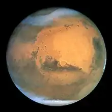 火星 火星 |
| 場所 | タルシス |
| 座標 | 北緯1.48度 東経247.04度[1] |
| 標高 | 14 km |
| 発見者 | マリナー9号 |
| 名の由来 | ラテン語のクジャク |
巨大な楯状火山であり、火星の赤道付近の東経235度から259度の範囲にかけて広がる。
パヴォニス山は1971年のマリナー9号により発見された地形で、発見当初はMiddle Spotと呼ばれていた[3]。現在の名前は1973年に付けられたもので[4]、ラテン語のクジャクに由来する。
画像
 パヴォニス山(MGS撮影)。
 パヴォニス山の山頂付近(〃)。
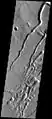 南側斜面の流路と穴(2001マーズ・オデッセイ撮影)。
 南側斜面のスコリア丘。
 山頂のカルデラ。
 南側斜面で見つかった180mほどの溶岩洞とみられる穴(〃)。
脚注
- "パヴォニス山". Gazetteer of Planetary Nomenclature. USGS Astrogeology Research Program.
- "パヴォニス山". Gazetteer of Planetary Nomenclature. USGS Astrogeology Research Program.
- Carr, Michael H. (1973). “Volcanism on Mars”. Journal of Geophysical Research 78: 4049–4062. Bibcode: 1973JGR....78.4049C. doi:10.1029/JB078i020p04049.
- “Gazetteer of Planetary Nomenclature”. planetarynames.wr.usgs.gov. 2016年5月20日閲覧。
関連項目
外部リンク


This article is issued from Wikipedia. The text is licensed under Creative Commons - Attribution - Sharealike. Additional terms may apply for the media files.