ミャンマー地震 (2016年4月)
ミャンマー地震(ミャンマーじしん)は、2016年4月13日20時25分(ミャンマー標準時、日本時間22時55分)に、ミャンマーマンダレーの北西135 km (84 mi)を震源として発生したマグニチュード6.9の地震で[4]、最大震度はVI(強い)を観測した。震源の深さは134 km[5]。新華社通信によると揺れは1分間続いた[6]。
| ミャンマー地震(2016年4月) | |
|---|---|
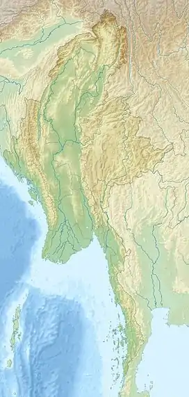  | |
| 本震 | |
| 発生日 | 2016年4月13日 |
| 発生時刻 | 20時25分(現地時間) |
| 座標 | 北緯23.094度 東経94.865度[1] |
| 震源の深さ | 136.0 km (84.5 mi)[1] km |
| 規模 | M6.9 |
| 余震 | |
| 回数 | 1[2][3] |
| 被害 | |
| 死傷者数 |
2人死亡 120人負傷 |
| 被害地域 |
 バングラデシュ バングラデシュ  インド インド  ミャンマー ミャンマー  ネパール ネパール |
|
| |
| プロジェクト:地球科学 プロジェクト:災害 | |
出典
- “M6.9 - 75km SE of Mawlaik, Burma”. USGS. 2016年4月13日閲覧。
- “M4.6 - 31km NW of Mawlaik, Burma”. 2016年4月15日閲覧。
- “Earthquakes”. 2016年4月15日閲覧。
- “Myanmar shaken by 6.9 magnitude earthquake”. BBC News. (2016年4月13日) 2016年4月13日閲覧。
- “Earthquake hits Myanmar, no immediate reports of major damage”. Reuters. (2016年4月13日) 2016年4月13日閲覧。
- “Strong quake hits Myanmar, tremors felt in India”. www.aljazeera.com. 2016年4月14日閲覧。
関連項目
This article is issued from Wikipedia. The text is licensed under Creative Commons - Attribution - Sharealike. Additional terms may apply for the media files.