レバノン (カンザス州)
レバノン(Lebanon)は、アメリカ合衆国カンザス州スミス郡の北部中央に位置する都市。 人口は218人(2010年国勢調査)である。
Lebanon, Kansas | |
|---|---|
|
都市 | |
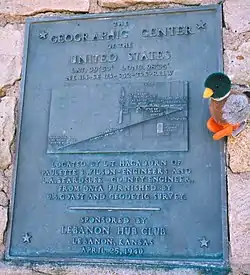 アメリカ合衆国の geographic center を示すモニュメントの銘板 (2007) | |
 | |
| 北緯39度48分38秒 西経98度33分22秒 | |
| 国 | アメリカ合衆国 |
| 州 | カンザス州 |
| 郡 | スミス郡 |
| 政府 | |
| • 種別 | 市長=議会 |
| • 市長 | Duane Ream [1] |
| • City Clerk | Connie Herndon [1] |
| 面積 | |
| • 合計 | 0.32 mi2 (0.83 km2) |
| • 陸地 | 0.32 mi2 (0.83 km2) |
| • 水域 | 0 mi2 (0 km2) |
| 標高 | 1,844 ft (562 m) |
| 人口 (2010)[3] | |
| • 合計 | 218人 |
| • 推計 (2012[4]) | 212人 |
| • 密度 | 680人/mi2 (260人/km2) |
| 等時帯 | UTC-6 (中部 (CST)) |
| • 夏時間 | UTC-5 (CDT) |
| ZIPコード |
66952 |
| エリアコード | 785 |
| FIPSコード | 20-39100 [5] |
| GNIS feature ID | 0471973 [6] |
| ウェブサイト | City Website |
この都市には、1898年に測量によって、接続している(水域によって隔たっていない)米48州の geographic center として政府に認められた地点があり、そこにはそれを記念したモニュメントもある。
なお、「測量士による科学的検証により geographic center である事が正式に政府に認められ」などといった表現が見られることもあるようだが、どのようにそのような地点を決めるか、むしろ科学的には検証などできないので、en:Geographical centre の記事では、アメリカ地質調査所のドキュメントに "There is no generally accepted definition of geographic center, and no completely satisfactory method for determining it." とある、と引用している(一言で言えば、そんなものは決められないよ、と書かれている)。
脚注
- Lebanon - Directory of Public Officials
- “US Gazetteer files 2010”. United States Census Bureau. 2012年7月6日閲覧。
- “American FactFinder”. United States Census Bureau. 2012年7月6日閲覧。
- “Population Estimates”. United States Census Bureau. 2013年5月29日閲覧。
- “American FactFinder”. United States Census Bureau. 2008年1月31日閲覧。
- “US Board on Geographic Names”. United States Geological Survey (2007年10月25日). 2008年1月31日閲覧。
外部リンク
- U.S. Center Foundation
- Geographical Center of the Continental United States
- An explanation of how the Geographical Center was identified
- What you might find there



This article is issued from Wikipedia. The text is licensed under Creative Commons - Attribution - Sharealike. Additional terms may apply for the media files.