アッパー・タクトゥ=アッパー・エセキボ州
アッパー・タクトゥ=アッパー・エセキボ州(アッパー・タクトゥ=アッパー・エセキボしゅう、英語: Upper Takutu-Upper Esequibo)または第9州(英語: Region 9[3])とは、ガイアナ南部の州である。州都はレセム[4]。1980年に設置された[4]。人口は11,077人(2012年国勢調査[1])、面積は57,750キロメートルで、ガイアナで最も面積の大きな州である[1]。
アッパー・タクトゥ=アッパー・エセキボ州 (第9州) Upper Takutu-Upper Esequibo (Region 9) | |
|---|---|
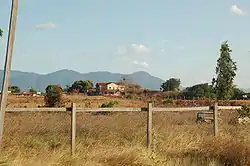 州都レセム | |
.svg.png.webp) ガイアナ国内におけるアッパー・タクトゥ=アッパー・エセキボ州の位置 | |
| 国 |
 ガイアナ ガイアナ |
| 成立 | 1980年 |
| 州都 | レセム |
| 面積 | |
| • 合計 | 57,750 km2 |
| 人口 (2012)[1] | |
| • 合計 | 24,238人 |
| • 密度 | 0.42人/km2 |
| 等時帯 | UTC-4 (ガイアナ時間) |
| ISO 3166コード | GY-UT |
| [2] | |
ルプヌニ川とブラジル国境間にはルプヌニサバンナが広がる。州の大部分の領域はベネズエラが領有権を主張するグアヤナエセキバ内に位置している[5]。
隣接州
北はポタロ=シパルニ州、東は東ベルビセ=コレンティネ州、南と西はブラジル(パラー州、ロライマ州)に接する。
人口
ガイアナでは1980年、1991年、2002年に計3度の国勢調査が行われた[6][7] 2012年の州の人口は24,238 人だった[1]。州の人口動態は以下のとおりである:
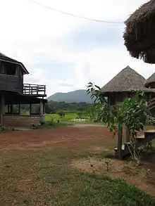
Surama
- 2012 : 24,238
- 2002 : 19,387
- 1991 : 15,058
- 1980 : 12,873
脚注
- “Guyana”. Citypopulation (2020年5月16日). 2024年1月30日閲覧。
- Macmillan Publishers (2009). “Administrative Regions - 8, 9 and 10”. Macmillan Junior Atlas: Guyana. Oxford: Macmillan Caribbean. p. 37. ISBN 9780333934173
- “Regional Democratic Councils”. Ministry of Local Government and Regional Development. 2024年1月30日閲覧。
- “Regions of Guyana”. Statoids (2015年11月5日). 2024年1月29日閲覧。
- “Essequibo: Venezuelans back claim to Guyana-controlled oil region”. BBC. (2023年12月4日) 2024年1月30日閲覧。
- Beaie, Sonkarley Tiatun (2007年9月19日). “National Population Trends: Size, Growth and Distribution” (PDF Download). 2002 Population and Housing Census - Guyana National Report. Bureau of Statistics. p. 25. 2012年8月29日閲覧。
- Beaie, Sonkarley Tiatun (2007年9月19日). “Chapter 3: National Redistribution and Internal Migration” (PDF). 2002 Population and Housing Census - Guyana National Report. Bureau of Statistics. p. 51. 2012年9月2日時点のオリジナルよりアーカイブ。2012年8月29日閲覧。
関連項目
| ガイアナの州(region) | |
|---|---|
| ガイアナの行政区画 | |
|
This article is issued from Wikipedia. The text is licensed under Creative Commons - Attribution - Sharealike. Additional terms may apply for the media files.