ルーズベルト・アイランド駅
ルーズベルト・アイランド駅(Roosevelt Island)は、マンハッタン区ルーズベルト島のメイン・ストリートに位置するニューヨーク市地下鉄IND63丁目線の駅で、F系統が終日停車する。
| |||||||
|---|---|---|---|---|---|---|---|
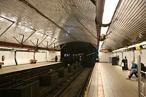 プラットホーム | |||||||
| 駅情報 | |||||||
| 住所 |
Main Street near Road 5 New York, NY 10044 | ||||||
| 区 | マンハッタン区 | ||||||
| 地区 | ルーズベルト・アイランド | ||||||
| 座標 | 北緯40.759188度 西経73.953438度 | ||||||
| ディビジョン | Bディビジョン(IND) | ||||||
| 路線 | IND63丁目線 | ||||||
| 運行系統 |
F  (終日) <F> (終日) <F> (ラッシュ時のみ) (ラッシュ時のみ) | ||||||
| 接続 |
 ルーズベルト・アイランド・トラムウェイ ルーズベルト・アイランド・トラムウェイ MTAバス: Q102 RIOC: レッドバス、オクタゴンエクスプレス MTAバス: Q102 RIOC: レッドバス、オクタゴンエクスプレス⛴ ニューヨーク市フェリー: アストリア行き | ||||||
| 構造 | 地下駅 | ||||||
| 駅深度 | 100フィート (30.5 m) | ||||||
| ホーム数 | 相対式ホーム 2面 | ||||||
| 線路数 | 2線 | ||||||
| その他の情報 | |||||||
| 開業日 | 1989年10月29日[1] | ||||||
| バリアフリー設備 |
 | ||||||
| 利用状況 | |||||||
| 乗客数 (2017) | 2,361,627[2]人  11.9% 11.9% | ||||||
| 順位 | 209位(425駅中) | ||||||
| 次の停車駅 | |||||||
|
| |||||||
| 北側の隣駅 |
21丁目-クイーンズブリッジ駅: F <F> | ||||||
| 南側の隣駅 |
レキシントン・アベニュー-63丁目駅: F <F> | ||||||
| |||||||
マーブル・ヒル-225丁目駅とともに、マンハッタン区にありながらマンハッタン島外にある2駅の1つとなっている[3]。
歴史
配線図 | |||||||||||||||||||||||||||||||||||||||||||||||||||||||||||||||||||||||||||||||||||||||||
|---|---|---|---|---|---|---|---|---|---|---|---|---|---|---|---|---|---|---|---|---|---|---|---|---|---|---|---|---|---|---|---|---|---|---|---|---|---|---|---|---|---|---|---|---|---|---|---|---|---|---|---|---|---|---|---|---|---|---|---|---|---|---|---|---|---|---|---|---|---|---|---|---|---|---|---|---|---|---|---|---|---|---|---|---|---|---|---|---|---|
| |||||||||||||||||||||||||||||||||||||||||||||||||||||||||||||||||||||||||||||||||||||||||


駅には当初Q系統が平日に、B系統が週末に停車し、どちらもIND6番街線に接続していた[1][7]。
21丁目-クイーンズブリッジ駅が終点だったころは、63丁目トンネルは「どこにもつながらないトンネル」といわれていた[1][8]。その後、2001年にINDクイーンズ・ブールバード線と接続、この際に停車系統が現在のF系統に変更された[9]:5[10] :2[11]。
駅構造
| G | 地上階 | 出入口 |
| 改札口、駅員詰所 (駅舎内にエレベーターあり) | ||
| B1 | 上層メザニン | エスカレーターの踊り場 |
| B2 | 下層メザニン | ホーム間連絡通路 |
| B3 ホーム階 |
相対式ホーム、右側ドアが開く | |
| 南行線 | ←   コニー・アイランド-スティルウェル・アベニュー駅行き (レキシントン・アベニュー-63丁目駅) コニー・アイランド-スティルウェル・アベニュー駅行き (レキシントン・アベニュー-63丁目駅) | |
| 北行線 | → ジャマイカ-179丁目駅行き (21丁目-クイーンズブリッジ駅) → | |
| 相対式ホーム、右側ドアが開く | ||
| B4 | 1番線 | ← ロングアイランド鉄道 イースト・サイド・アクセス (建設中) |
| 2番線 | ロングアイランド鉄道 イースト・サイド・アクセス (建設中) → | |
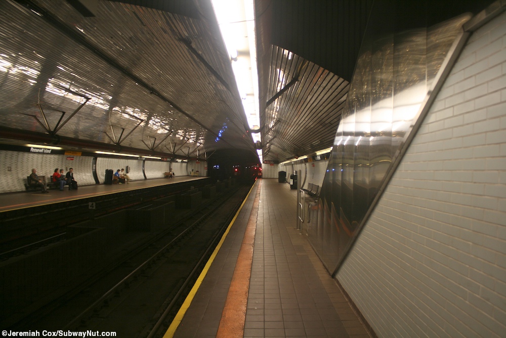
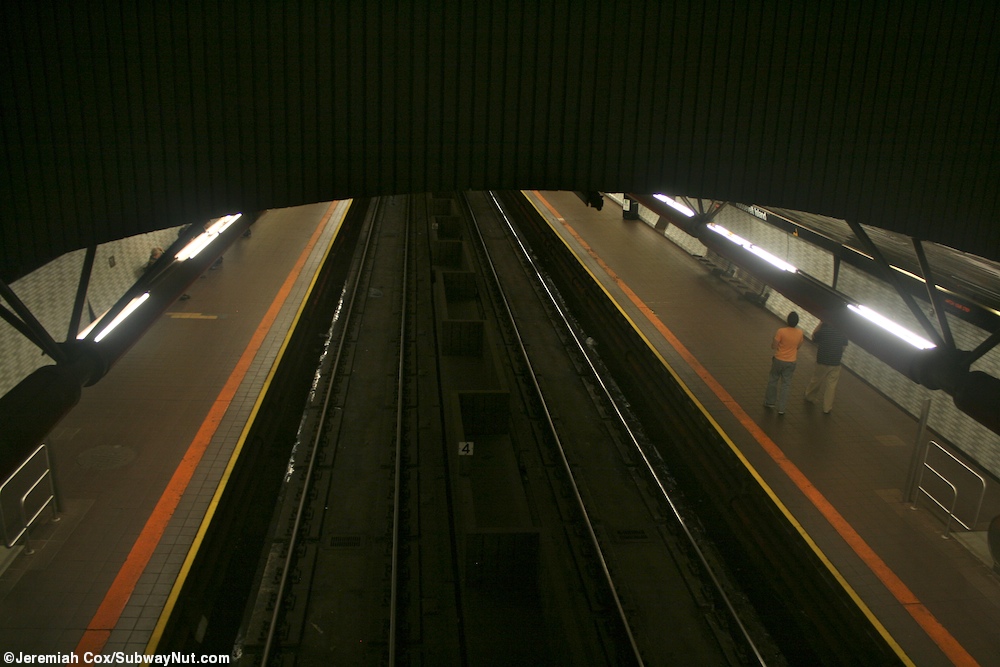
駅は相対式ホーム2面2線の駅で、ホームは63丁目トンネルに挟まれている関係で地上から約100フィート (30 m)下にあり、ニューヨーク市地下鉄で4番目に深い位置にある駅となっている[12]。また、改札は地上にあるためエスカレーターでは改札からホーム上の連絡通路の間に1か所踊り場がある[13][14][15]。
駅にはエレベーターが設置されておりADA対応駅である[16]。駅の西に転轍機があるほか、63丁目トンネルを抜けるとIND2番街線と接続予定の場所がある[17]:21[18]。ロングアイランド鉄道イースト・サイド・アクセスが使用する予定のトンネルが下にある[19][20][21]。
利用者数
開業当時からルーズベルト・アイランド・トラムウェイの利用者数は減少傾向で、1日当たりの利用者数は1989年に約5500人だったものが1993年に約3000人に落ち込んだ[24]。2008年には1日当たり約5900人が駅を利用した[25]。2016年の平日には6630人が利用した[26]。年間利用者数は2,110,471人となっている[2]。
周辺
ゴールドウォーター・メモリアル病院があるほか[22][27]、南にコーネル大学及びイスラエル工科大学コーネルキャンパスが2,000,000-平方フート (190,000 m2)の敷地内にある[22][28][29] メイン・ストリートにはグッド・シェパード教会がある[22]。これは1888年に建てられ、現在はアメリカ合衆国国家歴史登録財に指定されている[30]。また、ファイアーファイターズ・フィールドと呼ばれる野球場がある[22][31]。ルーズベルト・アイランド・トラムウェイが駅入口のすぐ南にのりばを設けている[22][32]。
画像
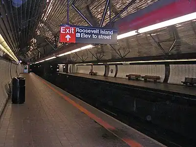 ホーム
ホーム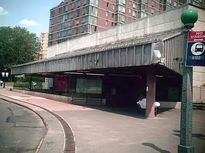 駅舎
駅舎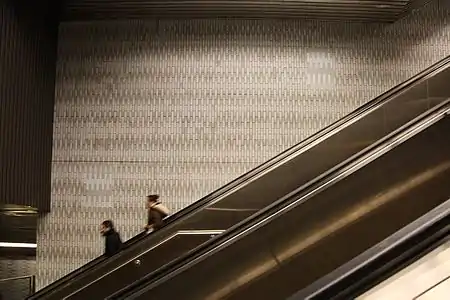 エスカレーター
脚注
注釈
出典
- Lorch, Donatella (1989年10月29日). “The 'Subway to Nowhere' Now Goes Somewhere”. The New York Times 2009年9月26日閲覧。
- “Facts and Figures: Annual Subway Ridership 2013–2018”. メトロポリタン・トランスポーテーション・オーソリティ (2019年7月18日). 2019年7月18日閲覧。
- “Subway Map” (PDF). Metropolitan Transportation Authority (2014年9月). 2014年10月7日閲覧。
- “63 St Subway Extension Opened 25 Years Ago this Week”. www.mta.info. Metropolitan Transportation Authority (2014年10月31日). 2017年6月12日閲覧。
- Kershaw, Sarah (2001年12月17日). “V Train Begins Service Today, Giving Queens Commuters Another Option”. The New York Times 2011年10月16日閲覧。
- Howe, Marvine (1993年12月26日). “NEIGHBORHOOD REPORT: ROOSEVELT ISLAND; When Will Troubled Tram Reopen? Give It a Few More Weeks”. The New York Times. ISSN 0362-4331 2016年7月26日閲覧。
- Grynbaum, Michael M. (2009年11月25日). “If You Took the Train to the Plane, Sing the Jingle”. 2016年7月3日閲覧。
- “Proposed Subway Tube Assailed As ‘Nowhere‐to‐Nowhere’ Link”. The New York Times (1964年12月16日). 2015年9月27日閲覧。
- “Review of F Line Operations, Ridership, and Infrastructure”. nysenate.gov. MTA New York City Transit Authority (2009年10月7日). 2010年5月31日時点のオリジナルよりアーカイブ。2015年7月28日閲覧。
- “Review of the G Line”. mta.info. Metropolitan Transportation Authority (2013年7月10日). 2015年8月2日閲覧。
- Kennedy, Randy (2001年5月25日). “Panel Approves New V Train but Shortens G Line to Make Room”. The New York Times 2010年3月20日閲覧。
- “The Deepest and Highest Subway Stations in NYC: 191st St, 190th Street, Smith & 9th”. Untapped Cities (2013年6月26日). 2017年6月12日閲覧。
- Cox, Jeremiah (2010年5月24日). “Looking down the station platforms alongside an escalator”. subwaynut.com. 2017年6月12日閲覧。
- Cox, Jeremiah (2010年5月24日). “Looking down off the mezzanine to the tracks”. subwaynut.com. 2017年6月12日閲覧。
- Vega-Barachowitz, David (2008年2月15日). “Hanging Out with the Gangs of New York on Roosevelt Island”. Columbia Daily Spectator. 2016年12月21日閲覧。
- “Accessible Stations in the MTA Network”. web.mta.info. Metropolitan Transportation Authority. 2016年11月29日閲覧。
- “Tracks of the New York City Subway”. Tracks of the New York City Subway. 2015年10月9日閲覧。
- Brennan, Joseph (2002年). “Abandoned Stations: Lexington Ave (63 St) north side”. 2011年10月20日閲覧。
- Final Environmental Impact Statement for the 63rd Street Line Connection to the Queens Boulevard Line. Queens, New York, New York: Metropolitan Transportation Authority, United States Department of Transportation, Federal Transit Administration. (June 1992) 2016年7月23日閲覧。
- East Side Access in New York, Queens, and Bronx Counties, New York, and Nassau and Suffolk Counties, New York: Environmental Impact Statement. Metropolitan Transportation Authority, United States Department of Transportation, Federal Transit Administration. (March 2001) 2016年7月23日閲覧。
- “Project Overview”. MTA.info. 2014年4月21日閲覧。
- “MTA Neighborhood Maps: Long Island City”. mta.info. Metropolitan Transportation Authority (2015年). 2015年9月27日閲覧。
- Haughney, Christine (2012年3月18日). “M.T.A. Uses Bird Recordings to Scare Pigeons From Roosevelt Island Station”. The New York Times. ISSN 0362-4331 2016年7月26日閲覧。
- Howe, Marvine (1993年12月26日). “NEIGHBORHOOD REPORT: ROOSEVELT ISLAND; When Will Troubled Tram Reopen? Give It a Few More Weeks”. The New York Times. ISSN 0362-4331 2016年7月26日閲覧。
- Hernandez, Javier C. (2008年6月14日). “What Is Life Without a Tram? Residents Are Getting a Taste”. The New York Times. ISSN 0362-4331 2016年7月26日閲覧。
- “Facts and Figures: Average Weekday Subway Ridership 2013–2018”. メトロポリタン・トランスポーテーション・オーソリティ (2019年7月18日). 2019年7月18日閲覧。
- “Hospital Patients Forced Out as Roosevelt Island Tech Campus Moves In - Roosevelt Island”. DNAinfo.com. 2015年7月4日時点のオリジナルよりアーカイブ。2015年7月19日閲覧。
- Harris, Elizabeth A. (2017年9月13日). “High Tech and High Design, Cornell’s Roosevelt Island Campus Opens” (英語). The New York Times. ISSN 0362-4331 2017年9月13日閲覧。
- Lange, Alexandra (2017年9月13日). “Cornell Tech's new NYC campus puts sustainable architecture into practice”. Curbed NY. 2017年9月13日閲覧。
- National Park Service (23 January 2007). "National Register Information System". National Register of Historic Places. National Park Service.
{{cite web}}: Cite webテンプレートでは|access-date=引数が必須です。 (説明) - “Louis Pasteur Park Highlights - Firefighter Field : NYC Parks”. www.nycgovparks.org. 2016年7月28日閲覧。
- Brown, Nicole (2016年5月16日). “What to know about the Roosevelt Island Tram” (英語). am New York 2017年6月12日閲覧。